

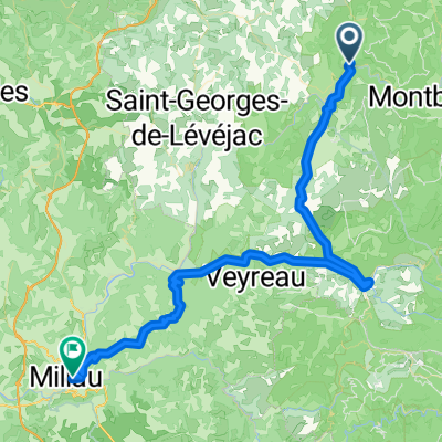
Ride Day 31—12 Oct 2005—48210 St-Chely du Tarn/Sainte Énimie to 48260 Recoules D'Aubrac (Nasbinals)
A cycling route starting in Chanac, Occitanie, France.
Overview
About this route
This was another ride under threatening skys all day…and we were again lucky not to get dumped on. The only discomforts were the cold wind and the fog at the higher elevations when we got into the Aubrac mountains near the end of the ride. While there, we were generally between 1200 M and 1250 M, with the maximum being 1280 M. Our warmer riding gear worked wonderfully. The countryside there, though, was great for cycling; such a pleasure to be in.
Along N9, we saw construction of a new bridge that reminded us of the viaduct we’d ridden under last year in 2004 just west of Millau. Part of this new bridge was hanging out with seemingly no support. A sign noted that the construction period was from 2003 to 2007. [In 2009, and perhaps other years as well, we again rode along here finding the bridge completed.]
Riding through Marvejols, we came across a sculpture of the Marvejols monster. Definitely a good place for a picture.
Background:My wife and I have been doing self-supported tours in Western Europe (a majority in France) since 1993. This series of rides covers our 2005 2 month route through parts of France. Our beginning and ending point is near Chaduri (south of Angoulême) where our friends have a farm with Gites and Chambres d'Hotes.We rode our Dawes touring bicycles purchased in 1993 heavily loaded with 700Cx32 tires. All of our riding was on paved roads, mostly with very little traffic.If any questions, feel free to email me at jeffkadet@netdiving.comJeff
- -:--
- Duration
- 86.1 km
- Distance
- 1,224 m
- Ascent
- 644 m
- Descent
- ---
- Avg. speed
- ---
- Max. altitude

Route quality
Waytypes & surfaces along the route
Waytypes
Quiet road
3.4 km
(4 %)
Access road
0.9 km
(1 %)
Surfaces
Paved
61.1 km
(71 %)
Unpaved
0.9 km
(1 %)
Asphalt
61.1 km
(71 %)
Gravel
0.9 km
(1 %)
Undefined
24.1 km
(28 %)
Continue with Bikemap
Use, edit, or download this cycling route
You would like to ride Ride Day 31—12 Oct 2005—48210 St-Chely du Tarn/Sainte Énimie to 48260 Recoules D'Aubrac (Nasbinals) or customize it for your own trip? Here is what you can do with this Bikemap route:
Free features
- Save this route as favorite or in collections
- Copy & plan your own version of this route
- Split it into stages to create a multi-day tour
- Sync your route with Garmin or Wahoo
Premium features
Free trial for 3 days, or one-time payment. More about Bikemap Premium.
- Navigate this route on iOS & Android
- Export a GPX / KML file of this route
- Create your custom printout (try it for free)
- Download this route for offline navigation
Discover more Premium features.
Get Bikemap PremiumFrom our community
Other popular routes starting in Chanac
 Ste. Enimie - Millau (Causse Route nr. 159)
- Distance
- 76.7 km
- Ascent
- 1,119 m
- Descent
- 1,262 m
- Location
- Chanac, Occitanie, France
 F124-2024-Chanac-Einrollen-Trekking
- Distance
- 58.7 km
- Ascent
- 1,670 m
- Descent
- 1,670 m
- Location
- Chanac, Occitanie, France
 F120-2024-Chanac-Saint Emine-La Malene-Chanac
- Distance
- 61.1 km
- Ascent
- 2,248 m
- Descent
- 2,255 m
- Location
- Chanac, Occitanie, France
 F123-2024-Chanac-Correjac-Le Balmes-Chanac
- Distance
- 42.9 km
- Ascent
- 1,243 m
- Descent
- 1,244 m
- Location
- Chanac, Occitanie, France
 1999 Radlour am Tarn
- Distance
- 90.3 km
- Ascent
- 1,143 m
- Descent
- 1,115 m
- Location
- Chanac, Occitanie, France
 F125-2024-Chanac-La Tieule-Chanac
- Distance
- 65.1 km
- Ascent
- 1,794 m
- Descent
- 1,798 m
- Location
- Chanac, Occitanie, France
 Ride Day 30—11 Oct 2005—48210 St-Chely du Tarn/Sainte Énimie — Circle
- Distance
- 58 km
- Ascent
- 951 m
- Descent
- 951 m
- Location
- Chanac, Occitanie, France
 Ride Day 31—12 Oct 2005—48210 St-Chely du Tarn/Sainte Énimie to 48260 Recoules D'Aubrac (Nasbinals)
- Distance
- 86.1 km
- Ascent
- 1,224 m
- Descent
- 644 m
- Location
- Chanac, Occitanie, France
Open it in the app