

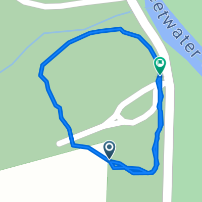
Sweetwater 95km
A cycling route starting in Lithia Springs, Georgia, United States.
Overview
About this route
- -:--
- Duration
- 95 km
- Distance
- 1,427 m
- Ascent
- 1,426 m
- Descent
- ---
- Avg. speed
- 369 m
- Max. altitude

Continue with Bikemap
Use, edit, or download this cycling route
You would like to ride Sweetwater 95km or customize it for your own trip? Here is what you can do with this Bikemap route:
Free features
- Save this route as favorite or in collections
- Copy & plan your own version of this route
- Split it into stages to create a multi-day tour
- Sync your route with Garmin or Wahoo
Premium features
Free trial for 3 days, or one-time payment. More about Bikemap Premium.
- Navigate this route on iOS & Android
- Export a GPX / KML file of this route
- Create your custom printout (try it for free)
- Download this route for offline navigation
Discover more Premium features.
Get Bikemap PremiumFrom our community
Other popular routes starting in Lithia Springs
 sweetwater hike
- Distance
- 6.6 km
- Ascent
- 153 m
- Descent
- 157 m
- Location
- Lithia Springs, Georgia, United States
 Sweetwater 95km
- Distance
- 95 km
- Ascent
- 1,427 m
- Descent
- 1,426 m
- Location
- Lithia Springs, Georgia, United States
 Mount Vernon Rd, Lithia Springs to Mount Vernon Rd, Lithia Springs
- Distance
- 1 km
- Ascent
- 10 m
- Descent
- 11 m
- Location
- Lithia Springs, Georgia, United States
 Mount Vernon Road 1750, Lithia Springs to Mount Vernon Road 1750, Lithia Springs
- Distance
- 7.6 km
- Ascent
- 108 m
- Descent
- 106 m
- Location
- Lithia Springs, Georgia, United States
 Douglasville to 2171 Mack Rd, Douglasville
- Distance
- 3.7 km
- Ascent
- 71 m
- Descent
- 64 m
- Location
- Lithia Springs, Georgia, United States
 Atlanta to 6816 Burkhead Dr, Union City
- Distance
- 18.3 km
- Ascent
- 227 m
- Descent
- 191 m
- Location
- Lithia Springs, Georgia, United States
 4292–4302 Ben Hill Rd, Lithia Springs a 60 E Chestnut Dr, Dallas
- Distance
- 27.5 km
- Ascent
- 208 m
- Descent
- 185 m
- Location
- Lithia Springs, Georgia, United States
Open it in the app