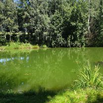
Vír - Sedlejov
A cycling route starting in Bystřice nad Pernštejnem, Kraj Vysočina, Czechia.
Overview
About this route
Moravské vrchoviny a Haná,
- etapa:
Hornosvratecká a Křižanovská vrchovina.
- -:--
- Duration
- 95.6 km
- Distance
- 862 m
- Ascent
- 741 m
- Descent
- ---
- Avg. speed
- ---
- Max. altitude
Route highlights
Points of interest along the route
Drinking water after 3.6 km
Karel Krondráf, Masarykovo náměstí 4, 59301 Bystřice nad Pernštejnem
Drinking water after 3.9 km
KALINA CYKLO, Bratrská 99, 593 01 Bystřice nad Pernštejnem
Point of interest after 21.4 km
Bobrová, pramen Bobrovská
Point of interest after 25.5 km
Radešín, studánka U Radešína (na břehu Cihelného rybníka)
Drinking water after 74.2 km
Jan Svěrák, Náměstí Svobody 379, 588 32 Brtnice
Continue with Bikemap
Use, edit, or download this cycling route
You would like to ride Vír - Sedlejov or customize it for your own trip? Here is what you can do with this Bikemap route:
Free features
- Save this route as favorite or in collections
- Copy & plan your own version of this route
- Split it into stages to create a multi-day tour
- Sync your route with Garmin or Wahoo
Premium features
Free trial for 3 days, or one-time payment. More about Bikemap Premium.
- Navigate this route on iOS & Android
- Export a GPX / KML file of this route
- Create your custom printout (try it for free)
- Download this route for offline navigation
Discover more Premium features.
Get Bikemap PremiumFrom our community
Other popular routes starting in Bystřice nad Pernštejnem
 BNP - Skalák - Bohuňov - DNP
- Distance
- 15.3 km
- Ascent
- 182 m
- Descent
- 179 m
- Location
- Bystřice nad Pernštejnem, Kraj Vysočina, Czechia
 Bystrice nad Pernstejnem okruh - 38 km
- Distance
- 37.9 km
- Ascent
- 556 m
- Descent
- 556 m
- Location
- Bystřice nad Pernštejnem, Kraj Vysočina, Czechia
 Nedvědicko a Sýkoř
- Distance
- 48.6 km
- Ascent
- 853 m
- Descent
- 856 m
- Location
- Bystřice nad Pernštejnem, Kraj Vysočina, Czechia
 Rozhledny Bystřicka
- Distance
- 44.3 km
- Ascent
- 969 m
- Descent
- 968 m
- Location
- Bystřice nad Pernštejnem, Kraj Vysočina, Czechia
 Vír - Sedlejov
- Distance
- 95.6 km
- Ascent
- 862 m
- Descent
- 741 m
- Location
- Bystřice nad Pernštejnem, Kraj Vysočina, Czechia
 Borovinka 4.den
- Distance
- 36 km
- Ascent
- 617 m
- Descent
- 616 m
- Location
- Bystřice nad Pernštejnem, Kraj Vysočina, Czechia
 Vír - Chlum - Rovečné - Malé Tresné - Vír (pěšky)
- Distance
- 15.2 km
- Ascent
- 447 m
- Descent
- 448 m
- Location
- Bystřice nad Pernštejnem, Kraj Vysočina, Czechia
 Bystrice nP - Konikovske polesi - Bystrice nP
- Distance
- 34.8 km
- Ascent
- 476 m
- Descent
- 477 m
- Location
- Bystřice nad Pernštejnem, Kraj Vysočina, Czechia
Open it in the app


