

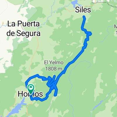
Pontones - Pozo Alcón
A cycling route starting in Segura de la Sierra, Andalusia, Spain.
Overview
About this route
Ruta para bici de carretera.
- -:--
- Duration
- 144.3 km
- Distance
- 3,197 m
- Ascent
- 3,687 m
- Descent
- ---
- Avg. speed
- 1,448 m
- Max. altitude

Route quality
Waytypes & surfaces along the route
Waytypes
Busy road
103.1 km
(71 %)
Road
27.3 km
(19 %)
Surfaces
Paved
54.8 km
(38 %)
Unpaved
4.5 km
(3 %)
Asphalt
51.3 km
(36 %)
Gravel
4.4 km
(3 %)
Route highlights
Points of interest along the route
Point of interest after 4.2 km
Cruce entre la "Carretera Nueva" y la antigua de "La Cuerda"
Point of interest after 12 km
Mirador de las Huelguecillas.
Point of interest after 16.6 km
Cruce para dejar la J-317 y bordear el embalse
Point of interest after 23.6 km
Conexión de la pista de CHG con la J-317 hacia Villanueva del Arzobispo.
Point of interest after 34.3 km
Presa del Embalse del Tranco.
Point of interest after 48.6 km
Mirador "Felix Rodríguez de la Fuente". Vistas sobre la isla y Castillo de Bujaraiza
Point of interest after 60.7 km
Torre del Vinagre. Museos y Jardín Botánico
Point of interest after 70.2 km
Entrada a Arroyo Frío
Point of interest after 81.3 km
Puerto de Las Palomas
Point of interest after 113.2 km
Inicio de ascensión al Puerto de Tíscar.
Point of interest after 121.4 km
Puerto de Tiscar
Point of interest after 126.6 km
Cueva del Agua o Cueva de la Virgen de Tiscar
Continue with Bikemap
Use, edit, or download this cycling route
You would like to ride Pontones - Pozo Alcón or customize it for your own trip? Here is what you can do with this Bikemap route:
Free features
- Save this route as favorite or in collections
- Copy & plan your own version of this route
- Split it into stages to create a multi-day tour
- Sync your route with Garmin or Wahoo
Premium features
Free trial for 3 days, or one-time payment. More about Bikemap Premium.
- Navigate this route on iOS & Android
- Export a GPX / KML file of this route
- Create your custom printout (try it for free)
- Download this route for offline navigation
Discover more Premium features.
Get Bikemap PremiumFrom our community
Other popular routes starting in Segura de la Sierra
 Cazorla 2013
- Distance
- 128 km
- Ascent
- 1,365 m
- Descent
- 1,365 m
- Location
- Segura de la Sierra, Andalusia, Spain
 Hornos - Pontones - Nacimiento del Segura - Pontones - Hornos
- Distance
- 60.7 km
- Ascent
- 1,051 m
- Descent
- 1,051 m
- Location
- Segura de la Sierra, Andalusia, Spain
 Hornos - El Robledo - Yelmo - GR 247 - Hornos
- Distance
- 40.3 km
- Ascent
- ---
- Descent
- ---
- Location
- Segura de la Sierra, Andalusia, Spain
 Cazorla (El Yelmo - La Cumbre - Alto de Acebeas)
- Distance
- 94 km
- Ascent
- 1,919 m
- Descent
- 1,922 m
- Location
- Segura de la Sierra, Andalusia, Spain
 Sierra de Segura: Pontones, Huelga Utrera, Puntal de La Misa, Río Madera, Pontones
- Distance
- 69.4 km
- Ascent
- 1,351 m
- Descent
- 1,351 m
- Location
- Segura de la Sierra, Andalusia, Spain
 Hornos de Segura - Peal de Becerro
- Distance
- 89 km
- Ascent
- 990 m
- Descent
- 1,309 m
- Location
- Segura de la Sierra, Andalusia, Spain
 Subida al Yelmo por Hornos (A-317)
- Distance
- 21.7 km
- Ascent
- 1,208 m
- Descent
- 108 m
- Location
- Segura de la Sierra, Andalusia, Spain
 Ruta Homenaje
- Distance
- 77.1 km
- Ascent
- 1,543 m
- Descent
- 1,548 m
- Location
- Segura de la Sierra, Andalusia, Spain
Open it in the app