

ETAPPE 7 - Lyon nach Châteauneuf-sur-Isère
A cycling route starting in Sainte-Foy-lès-Lyon, Auvergne-Rhône-Alpes, France.
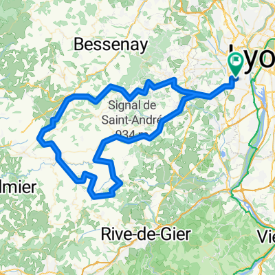
Overview
About this route
480 Les Communaux, 26300 Châteauneuf-sur-Isère, France
- -:--
- Duration
- 118.9 km
- Distance
- 370 m
- Ascent
- 420 m
- Descent
- ---
- Avg. speed
- 191 m
- Max. altitude

Route quality
Waytypes & surfaces along the route
Waytypes
Cycleway
57.1 km
(48 %)
Quiet road
25 km
(21 %)
Surfaces
Paved
88 km
(74 %)
Unpaved
4.8 km
(4 %)
Asphalt
85.6 km
(72 %)
Loose gravel
3.6 km
(3 %)
Continue with Bikemap
Use, edit, or download this cycling route
You would like to ride ETAPPE 7 - Lyon nach Châteauneuf-sur-Isère or customize it for your own trip? Here is what you can do with this Bikemap route:
Free features
- Save this route as favorite or in collections
- Copy & plan your own version of this route
- Split it into stages to create a multi-day tour
- Sync your route with Garmin or Wahoo
Premium features
Free trial for 3 days, or one-time payment. More about Bikemap Premium.
- Navigate this route on iOS & Android
- Export a GPX / KML file of this route
- Create your custom printout (try it for free)
- Download this route for offline navigation
Discover more Premium features.
Get Bikemap PremiumFrom our community
Other popular routes starting in Sainte-Foy-lès-Lyon
 Toboggan Fidésien 110Km
- Distance
- 113.3 km
- Ascent
- 2,641 m
- Descent
- 2,667 m
- Location
- Sainte-Foy-lès-Lyon, Auvergne-Rhône-Alpes, France
 Lyon-Corcelles
- Distance
- 61.9 km
- Ascent
- 189 m
- Descent
- 120 m
- Location
- Sainte-Foy-lès-Lyon, Auvergne-Rhône-Alpes, France
 3. Tag Rhone
- Distance
- 49.2 km
- Ascent
- 496 m
- Descent
- 279 m
- Location
- Sainte-Foy-lès-Lyon, Auvergne-Rhône-Alpes, France
 Toboggan 110km
- Distance
- 113.3 km
- Ascent
- 2,618 m
- Descent
- 2,644 m
- Location
- Sainte-Foy-lès-Lyon, Auvergne-Rhône-Alpes, France
 De 2 Chemin de la Croix Pivort, Sainte-Foy-lès-Lyon à Place du 8 Mai 1945, Chaponost
- Distance
- 7.4 km
- Ascent
- 151 m
- Descent
- 141 m
- Location
- Sainte-Foy-lès-Lyon, Auvergne-Rhône-Alpes, France
 Eastern Europe
- Distance
- 6,682.9 km
- Ascent
- 5,784 m
- Descent
- 5,461 m
- Location
- Sainte-Foy-lès-Lyon, Auvergne-Rhône-Alpes, France
 Toboggan 90Km
- Distance
- 93.7 km
- Ascent
- 2,067 m
- Descent
- 2,098 m
- Location
- Sainte-Foy-lès-Lyon, Auvergne-Rhône-Alpes, France
 Toboggan 60 Km
- Distance
- 60.7 km
- Ascent
- 1,224 m
- Descent
- 1,271 m
- Location
- Sainte-Foy-lès-Lyon, Auvergne-Rhône-Alpes, France
Open it in the app