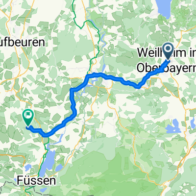
Weilheim in OB zum Staffelsee und über Wiesen und Felder zurück
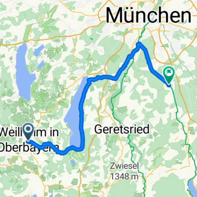
A cycling route starting in Weilheim, Bavaria, Germany.
Overview
About this route
- 4 h 48 min
- Duration
- 58.3 km
- Distance
- 1,968 m
- Ascent
- 1,967 m
- Descent
- 12.1 km/h
- Avg. speed
- 690 m
- Avg. speed
Route photos
Route quality
Waytypes & surfaces along the route
Waytypes
Quiet road
22.6 km
(39 %)
Track
15.9 km
(27 %)
Surfaces
Paved
39.6 km
(68 %)
Unpaved
15.4 km
(26 %)
Asphalt
37.8 km
(65 %)
Gravel
9.1 km
(16 %)
Continue with Bikemap
Use, edit, or download this cycling route
You would like to ride Weilheim in OB zum Staffelsee und über Wiesen und Felder zurück or customize it for your own trip? Here is what you can do with this Bikemap route:
Free features
- Save this route as favorite or in collections
- Copy & plan your own version of this route
- Sync your route with Garmin or Wahoo
Premium features
Free trial for 3 days, or one-time payment. More about Bikemap Premium.
- Navigate this route on iOS & Android
- Export a GPX / KML file of this route
- Create your custom printout (try it for free)
- Download this route for offline navigation
Discover more Premium features.
Get Bikemap PremiumFrom our community
Other popular routes starting in Weilheim
- Morgenrunde Richtung Haarsee
- Distance
- 10.6 km
- Ascent
- 86 m
- Descent
- 87 m
- Location
- Weilheim, Bavaria, Germany
- Weilheim in OB zum Staffelsee und über Wiesen und Felder zurück
- Distance
- 58.3 km
- Ascent
- 1,968 m
- Descent
- 1,967 m
- Location
- Weilheim, Bavaria, Germany
- Weilheim in Oberbayern nach Innsbruck
- Distance
- 125.9 km
- Ascent
- 1,967 m
- Descent
- 1,962 m
- Location
- Weilheim, Bavaria, Germany
- Murnau Staffelsee
- Distance
- 25.3 km
- Ascent
- 178 m
- Descent
- 95 m
- Location
- Weilheim, Bavaria, Germany
- Trainingsroute Weilheim - Raisting
- Distance
- 21.5 km
- Ascent
- 161 m
- Descent
- 164 m
- Location
- Weilheim, Bavaria, Germany
- Weilheim-Peiting
- Distance
- 53.2 km
- Ascent
- 699 m
- Descent
- 701 m
- Location
- Weilheim, Bavaria, Germany
- Schwaigerstraße 7, Weilheim i.OB nach Veilchenweg 4, Weilheim i.OB
- Distance
- 36.3 km
- Ascent
- 1,183 m
- Descent
- 1,122 m
- Location
- Weilheim, Bavaria, Germany
- Rund ums Weilheimer Moos mit Biergärten
- Distance
- 37.6 km
- Ascent
- 156 m
- Descent
- 156 m
- Location
- Weilheim, Bavaria, Germany
Open it in the app