

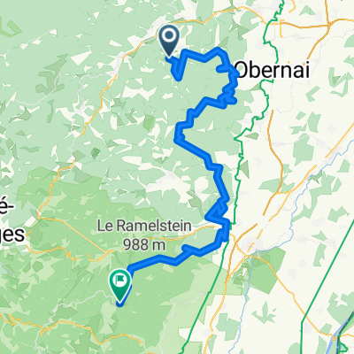
De Route de la Fischhutte 30, Mollkirch à Rue des Bateliers 24, Erstein
A cycling route starting in Grendelbruch, Grand Est, France.
Overview
About this route
- 4 h 17 min
- Duration
- 114.2 km
- Distance
- 985 m
- Ascent
- 1,221 m
- Descent
- 26.7 km/h
- Avg. speed
- 1,032 m
- Max. altitude

Continue with Bikemap
Use, edit, or download this cycling route
You would like to ride De Route de la Fischhutte 30, Mollkirch à Rue des Bateliers 24, Erstein or customize it for your own trip? Here is what you can do with this Bikemap route:
Free features
- Save this route as favorite or in collections
- Copy & plan your own version of this route
- Split it into stages to create a multi-day tour
- Sync your route with Garmin or Wahoo
Premium features
Free trial for 3 days, or one-time payment. More about Bikemap Premium.
- Navigate this route on iOS & Android
- Export a GPX / KML file of this route
- Create your custom printout (try it for free)
- Download this route for offline navigation
Discover more Premium features.
Get Bikemap PremiumFrom our community
Other popular routes starting in Grendelbruch
 De D214, Ottrott à 77 Rue de la Ganzau, Strasbourg
- Distance
- 43.4 km
- Ascent
- 58 m
- Descent
- 759 m
- Location
- Grendelbruch, Grand Est, France
 De Route de la Fischhutte 30, Mollkirch à Rue des Bateliers 24, Erstein
- Distance
- 114.2 km
- Ascent
- 985 m
- Descent
- 1,221 m
- Location
- Grendelbruch, Grand Est, France
 Grendelbruch - Fréland
- Distance
- 97.9 km
- Ascent
- 3,073 m
- Descent
- 2,963 m
- Location
- Grendelbruch, Grand Est, France
 Champ du Feu-Castillo de Haut-Koenigsbourg-Col de Freland
- Distance
- 108.5 km
- Ascent
- 2,394 m
- Descent
- 3,252 m
- Location
- Grendelbruch, Grand Est, France
 rothlach option 2
- Distance
- 24.2 km
- Ascent
- 101 m
- Descent
- 894 m
- Location
- Grendelbruch, Grand Est, France
 18 Chemin Oberlachmatt, Grendelbruch à 18 Chemin Oberlachmatt, Grendelbruch
- Distance
- 20.3 km
- Ascent
- 468 m
- Descent
- 473 m
- Location
- Grendelbruch, Grand Est, France
 Rothlach Rosheim
- Distance
- 24.5 km
- Ascent
- 217 m
- Descent
- 945 m
- Location
- Grendelbruch, Grand Est, France
 Guirbaden Mont Sainte Odile
- Distance
- 17.9 km
- Ascent
- 558 m
- Descent
- 354 m
- Location
- Grendelbruch, Grand Est, France
Open it in the app