2 expedicion extrema atvs enduroycross
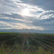
A cycling route starting in Cartago, Valle del Cauca Department, Colombia.
Overview
About this route
- -:--
- Duration
- 32.5 km
- Distance
- 1,062 m
- Ascent
- 784 m
- Descent
- ---
- Avg. speed
- ---
- Max. altitude
Route highlights
Points of interest along the route
Point of interest after 0.9 km
entrada hotel villa zaragoza
Point of interest after 19.3 km
escuela veredal
Point of interest after 22.3 km
corregimiento de villarrodas
Point of interest after 28.9 km
escuela
Continue with Bikemap
Use, edit, or download this cycling route
You would like to ride 2 expedicion extrema atvs enduroycross or customize it for your own trip? Here is what you can do with this Bikemap route:
Free features
- Save this route as favorite or in collections
- Copy & plan your own version of this route
- Sync your route with Garmin or Wahoo
Premium features
Free trial for 3 days, or one-time payment. More about Bikemap Premium.
- Navigate this route on iOS & Android
- Export a GPX / KML file of this route
- Create your custom printout (try it for free)
- Download this route for offline navigation
Discover more Premium features.
Get Bikemap PremiumFrom our community
Other popular routes starting in Cartago
- De Carrera 5 1553, Cartago a Calle 16 # 8-43, Cartago
- Distance
- 58.3 km
- Ascent
- 944 m
- Descent
- 675 m
- Location
- Cartago, Valle del Cauca Department, Colombia
- De Carrera 3b 24A-88, Cartago - Crgmto Cruces -Carrera 3b 24A-88, Cartago
- Distance
- 30.3 km
- Ascent
- 135 m
- Descent
- 136 m
- Location
- Cartago, Valle del Cauca Department, Colombia
- ruta de el tunel cerritos
- Distance
- 31.2 km
- Ascent
- 347 m
- Descent
- 347 m
- Location
- Cartago, Valle del Cauca Department, Colombia
- Cartago Salento
- Distance
- 79.7 km
- Ascent
- 1,639 m
- Descent
- 595 m
- Location
- Cartago, Valle del Cauca Department, Colombia
- De Calle 1 135, Cartago a Calle 1 135, Cartago
- Distance
- 29.7 km
- Ascent
- 185 m
- Descent
- 186 m
- Location
- Cartago, Valle del Cauca Department, Colombia
- cartago - alcala - pereira - cartago
- Distance
- 89.8 km
- Ascent
- 543 m
- Descent
- 544 m
- Location
- Cartago, Valle del Cauca Department, Colombia
- 2a valida departamental. copa valle de ciclomontañismo
- Distance
- 5.1 km
- Ascent
- 105 m
- Descent
- 105 m
- Location
- Cartago, Valle del Cauca Department, Colombia
- cartago-modin -la germania
- Distance
- 15.9 km
- Ascent
- 751 m
- Descent
- 163 m
- Location
- Cartago, Valle del Cauca Department, Colombia
Open it in the app