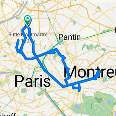
Spaziergang Montmartre ohne Weinberg
- 2.3 km
- 62 m
- 62 m
- Saint-Ouen, Île-de-France Region, France
A cycling route starting in Saint-Ouen, Île-de-France Region, France.
Overview
created this 2 years ago
Route quality
Cycleway
2.4 km
(32 %)
Pedestrian area
1.2 km
(16 %)
Paved
7.1 km
(94 %)
Asphalt
7.1 km
(94 %)
Undefined
0.5 km
(6 %)
Continue with Bikemap
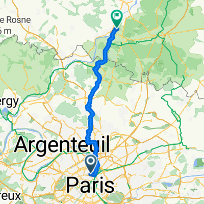
You would like to ride 40 Rue Custine, Paris à 40 Rue Robespierre, Bagnolet or customize it for your own trip? Here is what you can do with this Bikemap route:
Free trial for 3 days, or one-time payment. More about Bikemap Premium.
Discover more Premium features.
Get Bikemap PremiumFrom our community
Open it in the app