
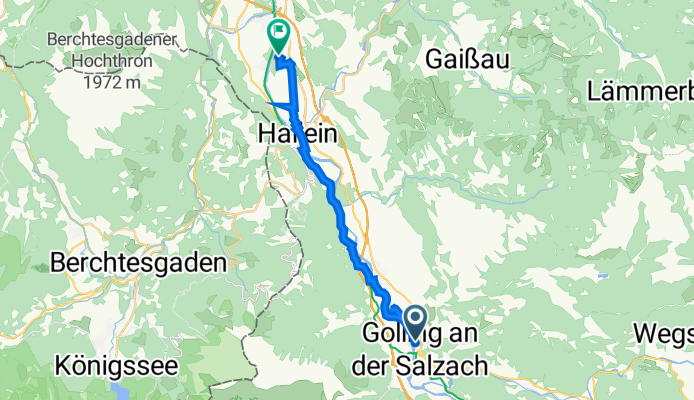
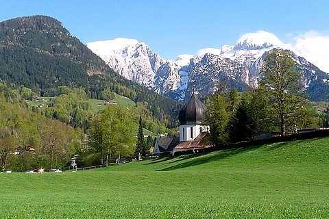
Golling-Abtenau Bahnhof, Golling an der Salzach nach Schulstraße 40
A cycling route starting in Golling an der Salzach, Salzburg, Austria.
Overview
About this route
- 1 h 42 min
- Duration
- 18.2 km
- Distance
- 97 m
- Ascent
- 188 m
- Descent
- 10.7 km/h
- Avg. speed
- 520 m
- Max. altitude

Route quality
Waytypes & surfaces along the route
Waytypes
Road
7.6 km
(42 %)
Quiet road
4.3 km
(24 %)
Surfaces
Paved
8.6 km
(47 %)
Unpaved
1.9 km
(10 %)
Asphalt
7.7 km
(43 %)
Unpaved (undefined)
1.1 km
(6 %)
Continue with Bikemap
Use, edit, or download this cycling route
You would like to ride Golling-Abtenau Bahnhof, Golling an der Salzach nach Schulstraße 40 or customize it for your own trip? Here is what you can do with this Bikemap route:
Free features
- Save this route as favorite or in collections
- Copy & plan your own version of this route
- Sync your route with Garmin or Wahoo
Premium features
Free trial for 3 days, or one-time payment. More about Bikemap Premium.
- Navigate this route on iOS & Android
- Export a GPX / KML file of this route
- Create your custom printout (try it for free)
- Download this route for offline navigation
Discover more Premium features.
Get Bikemap PremiumFrom our community
Other popular routes starting in Golling an der Salzach
 Mörderische Fahrt in Golling an der Salzach
- Distance
- 43.3 km
- Ascent
- 969 m
- Descent
- 969 m
- Location
- Golling an der Salzach, Salzburg, Austria
 Von Golling an der Salzach bis Salzburg
- Distance
- 33.7 km
- Ascent
- 402 m
- Descent
- 451 m
- Location
- Golling an der Salzach, Salzburg, Austria
 4. Golling-Siegsdorf-81km-850Hm
- Distance
- 85.4 km
- Ascent
- 1,141 m
- Descent
- 916 m
- Location
- Golling an der Salzach, Salzburg, Austria
 Von Golling an der Salzach bis Salzburg
- Distance
- 37.1 km
- Ascent
- 399 m
- Descent
- 448 m
- Location
- Golling an der Salzach, Salzburg, Austria
 1. Salzkammergut Seenrunde
- Distance
- 70.3 km
- Ascent
- 809 m
- Descent
- 625 m
- Location
- Golling an der Salzach, Salzburg, Austria
 Golling - Berchtesgadener - Runde
- Distance
- 53.1 km
- Ascent
- 1,584 m
- Descent
- 1,582 m
- Location
- Golling an der Salzach, Salzburg, Austria
 Route Bluntautal
- Distance
- 7.9 km
- Ascent
- 183 m
- Descent
- 182 m
- Location
- Golling an der Salzach, Salzburg, Austria
 2.7. Golling - Lofer
- Distance
- 78 km
- Ascent
- 1,703 m
- Descent
- 1,549 m
- Location
- Golling an der Salzach, Salzburg, Austria
Open it in the app