

De 196 Chemin de Sournure, Vinsobres à 10 Chemin des Magnanarelles, Vinsobres
A cycling route starting in Vinsobres, Auvergne-Rhône-Alpes, France.
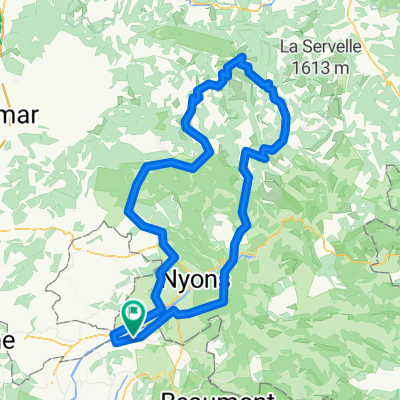
Overview
About this route
- 5 min
- Duration
- 0.9 km
- Distance
- 13 m
- Ascent
- 0 m
- Descent
- 11.6 km/h
- Avg. speed
- 285 m
- Max. altitude

Route quality
Waytypes & surfaces along the route
Waytypes
Quiet road
0.9 km
(93 %)
Track
0 km
(5 %)
Undefined
0 km
(2 %)
Surfaces
Paved
0.2 km
(25 %)
Asphalt
0.2 km
(25 %)
Undefined
0.7 km
(75 %)
Continue with Bikemap
Use, edit, or download this cycling route
You would like to ride De 196 Chemin de Sournure, Vinsobres à 10 Chemin des Magnanarelles, Vinsobres or customize it for your own trip? Here is what you can do with this Bikemap route:
Free features
- Save this route as favorite or in collections
- Copy & plan your own version of this route
- Sync your route with Garmin or Wahoo
Premium features
Free trial for 3 days, or one-time payment. More about Bikemap Premium.
- Navigate this route on iOS & Android
- Export a GPX / KML file of this route
- Create your custom printout (try it for free)
- Download this route for offline navigation
Discover more Premium features.
Get Bikemap PremiumFrom our community
Other popular routes starting in Vinsobres
 vinsobres MTB tocht
- Distance
- 56.7 km
- Ascent
- 774 m
- Descent
- 774 m
- Location
- Vinsobres, Auvergne-Rhône-Alpes, France
 2de route FR
- Distance
- 34.1 km
- Ascent
- 523 m
- Descent
- 522 m
- Location
- Vinsobres, Auvergne-Rhône-Alpes, France
 De Chemin Rural des Ramières, Saint-Maurice-sur-Eygues à 196 Chemin de Sournure, Vinsobres
- Distance
- 7.2 km
- Ascent
- 110 m
- Descent
- 19 m
- Location
- Vinsobres, Auvergne-Rhône-Alpes, France
 Stage Birlou 2015 étape 3
- Distance
- 203.7 km
- Ascent
- 1,837 m
- Descent
- 1,848 m
- Location
- Vinsobres, Auvergne-Rhône-Alpes, France
 Stage Birlou 2015 étape 2 bis
- Distance
- 117.3 km
- Ascent
- 1,220 m
- Descent
- 1,230 m
- Location
- Vinsobres, Auvergne-Rhône-Alpes, France
 Stage Birlou 2015 étape 2
- Distance
- 144.7 km
- Ascent
- 2,127 m
- Descent
- 2,128 m
- Location
- Vinsobres, Auvergne-Rhône-Alpes, France
 1ste route FR
- Distance
- 14.9 km
- Ascent
- 249 m
- Descent
- 249 m
- Location
- Vinsobres, Auvergne-Rhône-Alpes, France
 De 3 Allée des Louardes, Vinsobres à 22 Rue du Portail, Les Pilles
- Distance
- 14.5 km
- Ascent
- 138 m
- Descent
- 107 m
- Location
- Vinsobres, Auvergne-Rhône-Alpes, France
Open it in the app