

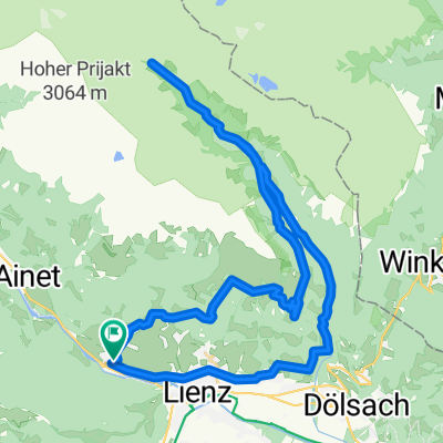
Oberlienz - Matrei - Oberlienz
A cycling route starting in Oberlienz, Tyrol, Austria.
Overview
About this route
- -:--
- Duration
- 52 km
- Distance
- 704 m
- Ascent
- 704 m
- Descent
- ---
- Avg. speed
- 988 m
- Max. altitude

Route quality
Waytypes & surfaces along the route
Waytypes
Quiet road
16.7 km
(32 %)
Road
15.8 km
(30 %)
Surfaces
Paved
19.1 km
(37 %)
Unpaved
0.3 km
(<1 %)
Asphalt
16.3 km
(31 %)
Paved (undefined)
2.8 km
(5 %)
Continue with Bikemap
Use, edit, or download this cycling route
You would like to ride Oberlienz - Matrei - Oberlienz or customize it for your own trip? Here is what you can do with this Bikemap route:
Free features
- Save this route as favorite or in collections
- Copy & plan your own version of this route
- Sync your route with Garmin or Wahoo
Premium features
Free trial for 3 days, or one-time payment. More about Bikemap Premium.
- Navigate this route on iOS & Android
- Export a GPX / KML file of this route
- Create your custom printout (try it for free)
- Download this route for offline navigation
Discover more Premium features.
Get Bikemap PremiumFrom our community
Other popular routes starting in Oberlienz
 Oberlienz-LienzerHütte
- Distance
- 44.2 km
- Ascent
- 1,738 m
- Descent
- 1,738 m
- Location
- Oberlienz, Tyrol, Austria
 AC22 Hochstein - Portze - Dreischuster
- Distance
- 120.8 km
- Ascent
- 5,226 m
- Descent
- 5,485 m
- Location
- Oberlienz, Tyrol, Austria
 Nassfeld_Bruneck
- Distance
- 417.4 km
- Ascent
- 6,618 m
- Descent
- 6,618 m
- Location
- Oberlienz, Tyrol, Austria
 Oberlienz-Weißensee-Oberlienz
- Distance
- 108.2 km
- Ascent
- 1,223 m
- Descent
- 1,222 m
- Location
- Oberlienz, Tyrol, Austria
 Lienz ailaghidi Neualplseen
- Distance
- 34.4 km
- Ascent
- 1,825 m
- Descent
- 1,808 m
- Location
- Oberlienz, Tyrol, Austria
 Lienz-Berg
- Distance
- 17.6 km
- Ascent
- 1,743 m
- Descent
- 61 m
- Location
- Oberlienz, Tyrol, Austria
 Tag 3 Lienz - Lienzer Hütte
- Distance
- 50.2 km
- Ascent
- 1,690 m
- Descent
- 1,708 m
- Location
- Oberlienz, Tyrol, Austria
 Oberlienz
- Distance
- 21.1 km
- Ascent
- 870 m
- Descent
- 861 m
- Location
- Oberlienz, Tyrol, Austria
Open it in the app