

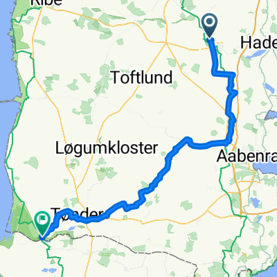
Dänemark_Etappe_1
A cycling route starting in Vojens, Region South Denmark, Denmark.
Overview
About this route
Vojens Bahnhof-Kolding
- -:--
- Duration
- 69.5 km
- Distance
- 341 m
- Ascent
- 377 m
- Descent
- ---
- Avg. speed
- 50 m
- Max. altitude

Route quality
Waytypes & surfaces along the route
Waytypes
Road
27.1 km
(39 %)
Quiet road
26.4 km
(38 %)
Surfaces
Paved
49.3 km
(71 %)
Unpaved
10.4 km
(15 %)
Asphalt
49.3 km
(71 %)
Gravel
6.9 km
(10 %)
Continue with Bikemap
Use, edit, or download this cycling route
You would like to ride Dänemark_Etappe_1 or customize it for your own trip? Here is what you can do with this Bikemap route:
Free features
- Save this route as favorite or in collections
- Copy & plan your own version of this route
- Sync your route with Garmin or Wahoo
Premium features
Free trial for 3 days, or one-time payment. More about Bikemap Premium.
- Navigate this route on iOS & Android
- Export a GPX / KML file of this route
- Create your custom printout (try it for free)
- Download this route for offline navigation
Discover more Premium features.
Get Bikemap PremiumFrom our community
Other popular routes starting in Vojens
 Oksenvad, Mølby, Øster Lindet
- Distance
- 23.4 km
- Ascent
- 61 m
- Descent
- 59 m
- Location
- Vojens, Region South Denmark, Denmark
 Dänemark_Etappe_1
- Distance
- 69.5 km
- Ascent
- 341 m
- Descent
- 377 m
- Location
- Vojens, Region South Denmark, Denmark
 Spætmejsevej to Rudbølvej
- Distance
- 84.8 km
- Ascent
- 85 m
- Descent
- 135 m
- Location
- Vojens, Region South Denmark, Denmark

Edge 820®
Vojens Cycling- Distance
- 62.1 km
- Ascent
- 180 m
- Descent
- 189 m
- Location
- Vojens, Region South Denmark, Denmark
 Vojens-Flensburg
- Distance
- 64.6 km
- Ascent
- 176 m
- Descent
- 209 m
- Location
- Vojens, Region South Denmark, Denmark
 Syd for Vojens
- Distance
- 31.9 km
- Ascent
- 81 m
- Descent
- 85 m
- Location
- Vojens, Region South Denmark, Denmark
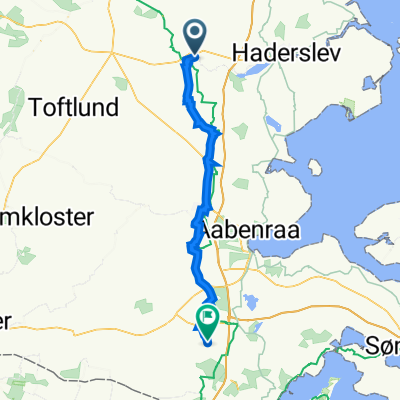 Østerled 2, Vojens to Søndervej 2, Aabenraa
- Distance
- 46.1 km
- Ascent
- 62 m
- Descent
- 75 m
- Location
- Vojens, Region South Denmark, Denmark
 Tørning
- Distance
- 4.4 km
- Ascent
- 60 m
- Descent
- 61 m
- Location
- Vojens, Region South Denmark, Denmark
Open it in the app