

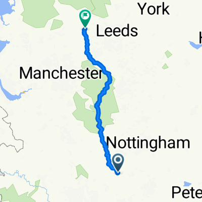
Swadlincote to Prestbury
A cycling route starting in Donisthorpe, England, United Kingdom.
Overview
About this route
- -:--
- Duration
- 91.8 km
- Distance
- 578 m
- Ascent
- 550 m
- Descent
- ---
- Avg. speed
- ---
- Max. altitude
Continue with Bikemap
Use, edit, or download this cycling route
You would like to ride Swadlincote to Prestbury or customize it for your own trip? Here is what you can do with this Bikemap route:
Free features
- Save this route as favorite or in collections
- Copy & plan your own version of this route
- Split it into stages to create a multi-day tour
- Sync your route with Garmin or Wahoo
Premium features
Free trial for 3 days, or one-time payment. More about Bikemap Premium.
- Navigate this route on iOS & Android
- Export a GPX / KML file of this route
- Create your custom printout (try it for free)
- Download this route for offline navigation
Discover more Premium features.
Get Bikemap PremiumFrom our community
Other popular routes starting in Donisthorpe
 Steady ride in
- Distance
- 7.8 km
- Ascent
- 69 m
- Descent
- 63 m
- Location
- Donisthorpe, England, United Kingdom
 The National Forest Cycle Centre, Willesley Wood Side, Ashby-De-La-Zouch to 57 Finch Close, Swadlincote
- Distance
- 4.7 km
- Ascent
- 51 m
- Descent
- 33 m
- Location
- Donisthorpe, England, United Kingdom
 Donisthorpe to Smisby to Packington to Donisthorpe
- Distance
- 20.9 km
- Ascent
- 252 m
- Descent
- 252 m
- Location
- Donisthorpe, England, United Kingdom
 Moira to Haworth draft
- Distance
- 171.2 km
- Ascent
- 1,646 m
- Descent
- 1,536 m
- Location
- Donisthorpe, England, United Kingdom
 Donisthorpe to Accresford to Lullington to Coton in the Elms to Donisthorpe
- Distance
- 20.4 km
- Ascent
- 196 m
- Descent
- 196 m
- Location
- Donisthorpe, England, United Kingdom
 Donisthiorpe - Blackfordby - Smisny - Lount - Ashby - Donisthorpe
- Distance
- 28.3 km
- Ascent
- 285 m
- Descent
- 284 m
- Location
- Donisthorpe, England, United Kingdom
 15km route
- Distance
- 14.9 km
- Ascent
- 121 m
- Descent
- 123 m
- Location
- Donisthorpe, England, United Kingdom
 #11 Warwickshire
- Distance
- 59.4 km
- Ascent
- 172 m
- Descent
- 187 m
- Location
- Donisthorpe, England, United Kingdom
Open it in the app