

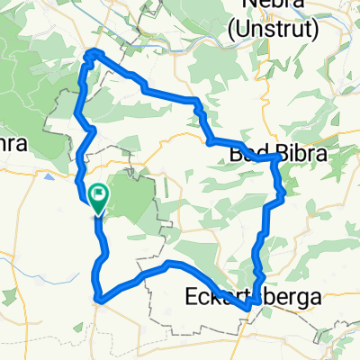
Mühltal 1A, Rastenberg nach Dorfstraße 71, Buchholz
A cycling route starting in Rastenberg, Thuringia, Germany.
Overview
About this route
- 21 h 52 min
- Duration
- 360 km
- Distance
- 1,378 m
- Ascent
- 1,519 m
- Descent
- 16.5 km/h
- Avg. speed
- 302 m
- Max. altitude
Route quality
Waytypes & surfaces along the route
Waytypes
Path
93.6 km
(26 %)
Quiet road
90 km
(25 %)
Surfaces
Paved
291.6 km
(81 %)
Unpaved
3.6 km
(1 %)
Asphalt
284.4 km
(79 %)
Paved (undefined)
3.6 km
(1 %)
Continue with Bikemap
Use, edit, or download this cycling route
You would like to ride Mühltal 1A, Rastenberg nach Dorfstraße 71, Buchholz or customize it for your own trip? Here is what you can do with this Bikemap route:
Free features
- Save this route as favorite or in collections
- Copy & plan your own version of this route
- Split it into stages to create a multi-day tour
- Sync your route with Garmin or Wahoo
Premium features
Free trial for 3 days, or one-time payment. More about Bikemap Premium.
- Navigate this route on iOS & Android
- Export a GPX / KML file of this route
- Create your custom printout (try it for free)
- Download this route for offline navigation
Discover more Premium features.
Get Bikemap PremiumFrom our community
Other popular routes starting in Rastenberg
 weimartour
- Distance
- 26.2 km
- Ascent
- 236 m
- Descent
- 222 m
- Location
- Rastenberg, Thuringia, Germany
 Von der Finne an die Ilm
- Distance
- 97.7 km
- Ascent
- 774 m
- Descent
- 792 m
- Location
- Rastenberg, Thuringia, Germany
 Rastenberg 60km-Eckartsberga-Bad Sulza-Klosterhäsler-Rastenberg
- Distance
- 60.6 km
- Ascent
- 522 m
- Descent
- 522 m
- Location
- Rastenberg, Thuringia, Germany
 Rund um die Finne
- Distance
- 60.3 km
- Ascent
- 411 m
- Descent
- 386 m
- Location
- Rastenberg, Thuringia, Germany
 Rastenberg-Freyburg-Rastenberg
- Distance
- 79.3 km
- Ascent
- 533 m
- Descent
- 531 m
- Location
- Rastenberg, Thuringia, Germany
 Hinter der Burg 5B, Rastenberg nach Am Flugplatz 1, Kölleda
- Distance
- 19.9 km
- Ascent
- 86 m
- Descent
- 149 m
- Location
- Rastenberg, Thuringia, Germany
 Feierabendrunde um die Fnne
- Distance
- 48.8 km
- Ascent
- 343 m
- Descent
- 286 m
- Location
- Rastenberg, Thuringia, Germany
 Rastenberg - Leutenthal - Rastenberg
- Distance
- 48.3 km
- Ascent
- 310 m
- Descent
- 310 m
- Location
- Rastenberg, Thuringia, Germany
Open it in the app