
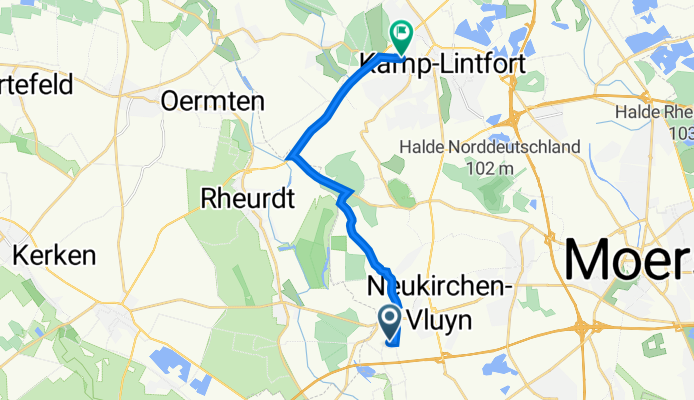
Pappelstraße 1B, Neukirchen-Vluyn nach Moerser Straße 57, Kamp-Lintfort
A cycling route starting in Rheurdt, North Rhine-Westphalia, Germany.
Overview
About this route
- 39 min
- Duration
- 11.4 km
- Distance
- 7 m
- Ascent
- 13 m
- Descent
- 17.6 km/h
- Avg. speed
- 35 m
- Avg. speed

Route quality
Waytypes & surfaces along the route
Waytypes
Path
7.5 km
(65 %)
Quiet road
2.8 km
(24 %)
Surfaces
Paved
10.9 km
(95 %)
Asphalt
10.8 km
(95 %)
Paved (undefined)
0 km
(<1 %)
Undefined
0.6 km
(5 %)
Continue with Bikemap
Use, edit, or download this cycling route
You would like to ride Pappelstraße 1B, Neukirchen-Vluyn nach Moerser Straße 57, Kamp-Lintfort or customize it for your own trip? Here is what you can do with this Bikemap route:
Free features
- Save this route as favorite or in collections
- Copy & plan your own version of this route
- Sync your route with Garmin or Wahoo
Premium features
Free trial for 3 days, or one-time payment. More about Bikemap Premium.
- Navigate this route on iOS & Android
- Export a GPX / KML file of this route
- Create your custom printout (try it for free)
- Download this route for offline navigation
Discover more Premium features.
Get Bikemap PremiumFrom our community
Other popular routes starting in Rheurdt
 Rheurdt - Krickebecker Seen - Rheurdt
- Distance
- 54.8 km
- Ascent
- 135 m
- Descent
- 135 m
- Location
- Rheurdt, North Rhine-Westphalia, Germany
 Aldekerk - Rheurdt - Vlyn - Aldekerk
- Distance
- 23.9 km
- Ascent
- 61 m
- Descent
- 62 m
- Location
- Rheurdt, North Rhine-Westphalia, Germany
 Rheurd - Straelen - Wachtendonk
- Distance
- 45.4 km
- Ascent
- 73 m
- Descent
- 73 m
- Location
- Rheurdt, North Rhine-Westphalia, Germany
 Schaephuysener Berg Runde
- Distance
- 5.6 km
- Ascent
- 58 m
- Descent
- 57 m
- Location
- Rheurdt, North Rhine-Westphalia, Germany
 Rundkurs K-Lintfort - Vluyn
- Distance
- 20 km
- Ascent
- 37 m
- Descent
- 38 m
- Location
- Rheurdt, North Rhine-Westphalia, Germany
 Hiltruds Geburtstag
- Distance
- 19.2 km
- Ascent
- 13 m
- Descent
- 14 m
- Location
- Rheurdt, North Rhine-Westphalia, Germany
 Rund um den Tönisberg, 20 km
- Distance
- 20.2 km
- Ascent
- 51 m
- Descent
- 48 m
- Location
- Rheurdt, North Rhine-Westphalia, Germany
 Rheurdt Kempen - St.Tönis
- Distance
- 43 km
- Ascent
- 58 m
- Descent
- 60 m
- Location
- Rheurdt, North Rhine-Westphalia, Germany
Open it in the app