

2–6 Impasse du Château, Saint-Genis-Laval à Quai Hippolyte Jayr, Lyon
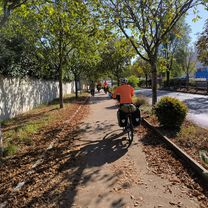
A cycling route starting in Saint-Genis-Laval, Auvergne-Rhône-Alpes, France.
Overview
About this route
- 1 h 59 min
- Duration
- 30.4 km
- Distance
- 224 m
- Ascent
- 296 m
- Descent
- 15.3 km/h
- Avg. speed
- 242 m
- Max. altitude

Route quality
Waytypes & surfaces along the route
Waytypes
Cycleway
17 km
(56 %)
Quiet road
3.3 km
(11 %)
Surfaces
Paved
26.2 km
(86 %)
Asphalt
24 km
(79 %)
Concrete
2.1 km
(7 %)
Undefined
4.3 km
(14 %)
Continue with Bikemap
Use, edit, or download this cycling route
You would like to ride 2–6 Impasse du Château, Saint-Genis-Laval à Quai Hippolyte Jayr, Lyon or customize it for your own trip? Here is what you can do with this Bikemap route:
Free features
- Save this route as favorite or in collections
- Copy & plan your own version of this route
- Sync your route with Garmin or Wahoo
Premium features
Free trial for 3 days, or one-time payment. More about Bikemap Premium.
- Navigate this route on iOS & Android
- Export a GPX / KML file of this route
- Create your custom printout (try it for free)
- Download this route for offline navigation
Discover more Premium features.
Get Bikemap PremiumFrom our community
Other popular routes starting in Saint-Genis-Laval
 retour
- Distance
- 10.1 km
- Ascent
- 136 m
- Descent
- 169 m
- Location
- Saint-Genis-Laval, Auvergne-Rhône-Alpes, France
 32. Tag Saint Genis Laval - Morestel
- Distance
- 84.6 km
- Ascent
- 532 m
- Descent
- 533 m
- Location
- Saint-Genis-Laval, Auvergne-Rhône-Alpes, France
 Etapa 081B (Saint Genis Laval - Saint Nazaire en Royans)
- Distance
- 159.3 km
- Ascent
- 674 m
- Descent
- 729 m
- Location
- Saint-Genis-Laval, Auvergne-Rhône-Alpes, France
 15) St GenisLaval - Condrieu
- Distance
- 41.1 km
- Ascent
- 264 m
- Descent
- 333 m
- Location
- Saint-Genis-Laval, Auvergne-Rhône-Alpes, France
 Avenue Maréchal Foch 88, Saint-Genis-Laval nach Chemin des Montats 122, Vion
- Distance
- 87.8 km
- Ascent
- 349 m
- Descent
- 437 m
- Location
- Saint-Genis-Laval, Auvergne-Rhône-Alpes, France
 SGL
SGL- Distance
- 4.3 km
- Ascent
- 42 m
- Descent
- 49 m
- Location
- Saint-Genis-Laval, Auvergne-Rhône-Alpes, France
 San Denis Laval - Saint Rambert d'Albon
- Distance
- 78.6 km
- Ascent
- 830 m
- Descent
- 955 m
- Location
- Saint-Genis-Laval, Auvergne-Rhône-Alpes, France
 Lyon Gre par le Vercors
- Distance
- 192 km
- Ascent
- 2,299 m
- Descent
- 2,312 m
- Location
- Saint-Genis-Laval, Auvergne-Rhône-Alpes, France
Open it in the app