

cadavica to mohacs
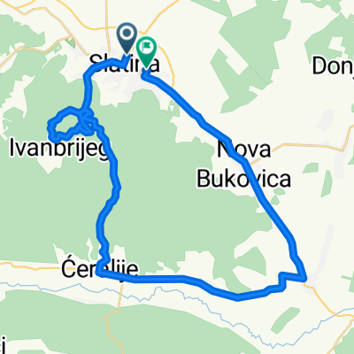
A cycling route starting in Slatina, Virovitica-Podravina County, Croatia.
Overview
About this route
- -:--
- Duration
- 95.4 km
- Distance
- 298 m
- Ascent
- 311 m
- Descent
- ---
- Avg. speed
- 141 m
- Max. altitude

Route quality
Waytypes & surfaces along the route
Waytypes
Cycleway
30.5 km
(32 %)
Quiet road
12.4 km
(13 %)
Surfaces
Paved
90.6 km
(95 %)
Asphalt
90.6 km
(95 %)
Undefined
4.8 km
(5 %)
Continue with Bikemap
Use, edit, or download this cycling route
You would like to ride cadavica to mohacs or customize it for your own trip? Here is what you can do with this Bikemap route:
Free features
- Save this route as favorite or in collections
- Copy & plan your own version of this route
- Split it into stages to create a multi-day tour
- Sync your route with Garmin or Wahoo
Premium features
Free trial for 3 days, or one-time payment. More about Bikemap Premium.
- Navigate this route on iOS & Android
- Export a GPX / KML file of this route
- Create your custom printout (try it for free)
- Download this route for offline navigation
Discover more Premium features.
Get Bikemap PremiumFrom our community
Other popular routes starting in Slatina
 Papuk
Papuk- Distance
- 216.7 km
- Ascent
- 1,925 m
- Descent
- 1,926 m
- Location
- Slatina, Virovitica-Podravina County, Croatia
 Slatina and surroundings
- Distance
- 42.5 km
- Ascent
- 292 m
- Descent
- 295 m
- Location
- Slatina, Virovitica-Podravina County, Croatia
 Slatina-D.Miholjac-Harkany-Barcs-Suhopolje-Slatina
- Distance
- 182 km
- Ascent
- 71 m
- Descent
- 73 m
- Location
- Slatina, Virovitica-Podravina County, Croatia
 Route in Slatina
- Distance
- 59.1 km
- Ascent
- 387 m
- Descent
- 389 m
- Location
- Slatina, Virovitica-Podravina County, Croatia
 cadavica to mohacs
- Distance
- 95.4 km
- Ascent
- 298 m
- Descent
- 311 m
- Location
- Slatina, Virovitica-Podravina County, Croatia
 b.s. uz rijeku Dravu
- Distance
- 21.6 km
- Ascent
- 22 m
- Descent
- 20 m
- Location
- Slatina, Virovitica-Podravina County, Croatia
 Papuk-kör
- Distance
- 108.8 km
- Ascent
- 1,058 m
- Descent
- 1,059 m
- Location
- Slatina, Virovitica-Podravina County, Croatia
 cadavica to harkany
- Distance
- 38.4 km
- Ascent
- 63 m
- Descent
- 71 m
- Location
- Slatina, Virovitica-Podravina County, Croatia
Open it in the app