Fournès - Circle to Écluse de Vallabrègues
A cycling route starting in Remoulins, Occitanie, France.
Overview
About this route
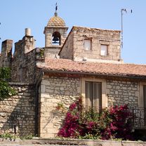
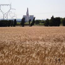
Today was an attempt to scout out our route for tomorrow... and it was a good thing we did. Google Maps put us on a goat path leading through some nice vineyards. We also found that the crossing of the Rhône at the Écluse de Vallabrègues was closed, though we were told it would be passable tomorrow. Maybe... Otherwise we were on nice roads with one wrong turn onto an unpaved cycling path along D2 and the Rhône.
As D2 had some traffic including large trucks, it is important to know that for almost all of the time we were on it, it had excellent road shoulder. Noisy riding, but otherwise OK.
As a cycling route goes through Aramon, there were a number of riders with panniers;
- 3 h 58 min
- Duration
- 49.8 km
- Distance
- 211 m
- Ascent
- 210 m
- Descent
- 12.5 km/h
- Avg. speed
- 63 m
- Max. altitude
Route photos
Route quality
Waytypes & surfaces along the route
Waytypes
Road
23.4 km
(47 %)
Quiet road
4.5 km
(9 %)
Surfaces
Paved
21.4 km
(43 %)
Unpaved
2.5 km
(5 %)
Asphalt
21.4 km
(43 %)
Gravel
2.5 km
(5 %)
Undefined
25.9 km
(52 %)
Continue with Bikemap
Use, edit, or download this cycling route
You would like to ride Fournès - Circle to Écluse de Vallabrègues or customize it for your own trip? Here is what you can do with this Bikemap route:
Free features
- Save this route as favorite or in collections
- Copy & plan your own version of this route
- Sync your route with Garmin or Wahoo
Premium features
Free trial for 3 days, or one-time payment. More about Bikemap Premium.
- Navigate this route on iOS & Android
- Export a GPX / KML file of this route
- Create your custom printout (try it for free)
- Download this route for offline navigation
Discover more Premium features.
Get Bikemap PremiumFrom our community
Other popular routes starting in Remoulins
 Les Baux-de-Provence
- Distance
- 91.5 km
- Ascent
- 399 m
- Descent
- 397 m
- Location
- Remoulins, Occitanie, France
 Provence 2004 1. Tag
- Distance
- 83.3 km
- Ascent
- 339 m
- Descent
- 237 m
- Location
- Remoulins, Occitanie, France
 Route 2 Remoulins - Les Beaux
- Distance
- 91.5 km
- Ascent
- 444 m
- Descent
- 444 m
- Location
- Remoulins, Occitanie, France
 remoulins 64
- Distance
- 64.1 km
- Ascent
- 513 m
- Descent
- 506 m
- Location
- Remoulins, Occitanie, France
 Day 4 (REWORKED)
- Distance
- 56.6 km
- Ascent
- 306 m
- Descent
- 204 m
- Location
- Remoulins, Occitanie, France
 Fournès - Circle to Écluse de Vallabrègues
- Distance
- 49.8 km
- Ascent
- 211 m
- Descent
- 210 m
- Location
- Remoulins, Occitanie, France
 Fournès to Maussane-les-Alpilles
- Distance
- 44.5 km
- Ascent
- 176 m
- Descent
- 193 m
- Location
- Remoulins, Occitanie, France
 route 3 remoulins
- Distance
- 81.8 km
- Ascent
- 640 m
- Descent
- 640 m
- Location
- Remoulins, Occitanie, France
Open it in the app


