

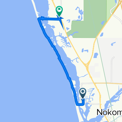
The Legacy Trail, Nokomis to Tamiami Trail S, Venice
A cycling route starting in Laurel, Florida, United States.
Overview
About this route
- 1 h 1 min
- Duration
- 10.5 km
- Distance
- 26 m
- Ascent
- 31 m
- Descent
- 10.3 km/h
- Avg. speed
- 10 m
- Max. altitude

Route quality
Waytypes & surfaces along the route
Waytypes
Cycleway
10.5 km
(100 %)
Surfaces
Paved
3.8 km
(37 %)
Asphalt
3.8 km
(37 %)
Undefined
6.6 km
(63 %)
Continue with Bikemap
Use, edit, or download this cycling route
You would like to ride The Legacy Trail, Nokomis to Tamiami Trail S, Venice or customize it for your own trip? Here is what you can do with this Bikemap route:
Free features
- Save this route as favorite or in collections
- Copy & plan your own version of this route
- Sync your route with Garmin or Wahoo
Premium features
Free trial for 3 days, or one-time payment. More about Bikemap Premium.
- Navigate this route on iOS & Android
- Export a GPX / KML file of this route
- Create your custom printout (try it for free)
- Download this route for offline navigation
Discover more Premium features.
Get Bikemap PremiumFrom our community
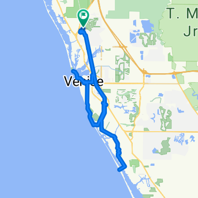
Other popular routes starting in Laurel
 Oscar Scherer State Park, Osprey to 1843 S Tamiami Trail, Osprey
- Distance
- 23.8 km
- Ascent
- 42 m
- Descent
- 41 m
- Location
- Laurel, Florida, United States
 5648 Cantucci St, Nokomis to 5560 Sentiero Dr, Nokomis
- Distance
- 23.2 km
- Ascent
- 0 m
- Descent
- 3 m
- Location
- Laurel, Florida, United States
 Rio Limpio Ln, Nokomis to 5560 Sentiero Dr, Nokomis
- Distance
- 4.1 km
- Ascent
- 0 m
- Descent
- 3 m
- Location
- Laurel, Florida, United States
 Saturday Ride
- Distance
- 9.6 km
- Ascent
- 26 m
- Descent
- 26 m
- Location
- Laurel, Florida, United States
 5581–5695 Cantucci St, Nokomis to 5560 Sentiero Dr, Nokomis
- Distance
- 23.3 km
- Ascent
- 0 m
- Descent
- 4 m
- Location
- Laurel, Florida, United States
 307 Shore Rd, Nokomis to 1100 S Tamiami Trail, Osprey
- Distance
- 9.8 km
- Ascent
- 3 m
- Descent
- 262 m
- Location
- Laurel, Florida, United States
 Recovered Route
- Distance
- 13.7 km
- Ascent
- 16 m
- Descent
- 13 m
- Location
- Laurel, Florida, United States
 50 for 50!!!
- Distance
- 52.2 km
- Ascent
- 105 m
- Descent
- 104 m
- Location
- Laurel, Florida, United States
Open it in the app