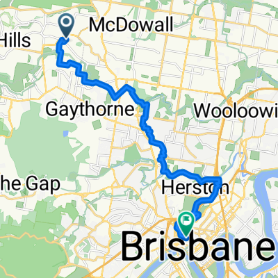
South Pine Rd, Everton Park to Widdop St, Hendra
- 12.7 km
- 54 m
- 71 m
- Everton Park, Queensland, Australia
A cycling route starting in Everton Park, Queensland, Australia.
Overview
This route is 80% bike path for 33km. It is comprised mainly of:
the Kedron Brook bikepath,
Kedron Brooke Rd,
Herston Street,
Victoria Park bikepath,
Roma Street Parklands,
Kurilpa Bridge,
Southbank pedestrian/bikepath (better to stay on northern side of river under expressway and cross at Goodwill bridge),
Pacific Motway bikepath,
O'Keefe Road,
Hanlon Park (Thompson State Reserve) bikepath,
Pacific Motorway again,
Snowden Road,
Toohey Road,
Toohey Forest Park (Toohey Ridge track and Nathan Ridge track - all bitumen),
West Ring Road,
Griffith Road,
Kessels Road,
Riewana Road (bike path on northern side),
Ends at Beaudesert road.
You can catch the train at Salisbury train station (1km north along Beaudesert Road - Right into Lillian Avenue then Dollis Street) as this is quite a long ride.
Very enjoyable and medium effort ride (not too many hills) along Kedron Brook and through Toohey Forest.
created this 14 years ago
Continue with Bikemap
You would like to ride Oxford Park (Mitchelton) to Archerfield CLONED FROM ROUTE 1100149 or customize it for your own trip? Here is what you can do with this Bikemap route:
Free trial for 3 days, or one-time payment. More about Bikemap Premium.
Discover more Premium features.
Get Bikemap PremiumFrom our community
Open it in the app