

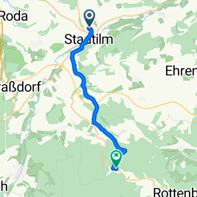
Heinrich-Heine-Straße 17, Stadtilm nach Heinrich-Heine-Straße 17, Stadtilm
A cycling route starting in Stadtilm, Free State of Thuringia, Germany.
Overview
About this route
- 1 h 49 min
- Duration
- 37.5 km
- Distance
- 195 m
- Ascent
- 247 m
- Descent
- 20.7 km/h
- Avg. speed
- 408 m
- Max. altitude
Route quality
Waytypes & surfaces along the route
Waytypes
Track
18 km
(48 %)
Path
5.6 km
(15 %)
Surfaces
Paved
34.8 km
(93 %)
Unpaved
1.3 km
(3 %)
Asphalt
33.6 km
(90 %)
Loose gravel
0.6 km
(2 %)
Continue with Bikemap
Use, edit, or download this cycling route
You would like to ride Heinrich-Heine-Straße 17, Stadtilm nach Heinrich-Heine-Straße 17, Stadtilm or customize it for your own trip? Here is what you can do with this Bikemap route:
Free features
- Save this route as favorite or in collections
- Copy & plan your own version of this route
- Sync your route with Garmin or Wahoo
Premium features
Free trial for 3 days, or one-time payment. More about Bikemap Premium.
- Navigate this route on iOS & Android
- Export a GPX / KML file of this route
- Create your custom printout (try it for free)
- Download this route for offline navigation
Discover more Premium features.
Get Bikemap PremiumFrom our community
Other popular routes starting in Stadtilm
 Ilm 1 (Stadtilm-Ilmursprung-Ilmenau)
- Distance
- 42.2 km
- Ascent
- 313 m
- Descent
- 197 m
- Location
- Stadtilm, Free State of Thuringia, Germany
 Stadtilm - Stausee Hohenfelden 21.08.2021
- Distance
- 37.8 km
- Ascent
- 434 m
- Descent
- 471 m
- Location
- Stadtilm, Free State of Thuringia, Germany
 Paulinzella
- Distance
- 12 km
- Ascent
- 156 m
- Descent
- 181 m
- Location
- Stadtilm, Free State of Thuringia, Germany
 Rinnetal - SaaleRadweg bis Jena
- Distance
- 70.3 km
- Ascent
- 195 m
- Descent
- 488 m
- Location
- Stadtilm, Free State of Thuringia, Germany
 Langewiesen 09.05.2021
- Distance
- 36 km
- Ascent
- 381 m
- Descent
- 384 m
- Location
- Stadtilm, Free State of Thuringia, Germany
 2016-10-31: Stadtilm - Großkochberg
- Distance
- 58.1 km
- Ascent
- 547 m
- Descent
- 545 m
- Location
- Stadtilm, Free State of Thuringia, Germany
 Kleinliebringen 20, Stadtilm nach L1106 10, Kaulsdorf
- Distance
- 35.2 km
- Ascent
- 376 m
- Descent
- 560 m
- Location
- Stadtilm, Free State of Thuringia, Germany
 Stadtilm - Großkochberg
- Distance
- 59.1 km
- Ascent
- 537 m
- Descent
- 540 m
- Location
- Stadtilm, Free State of Thuringia, Germany
Open it in the app