

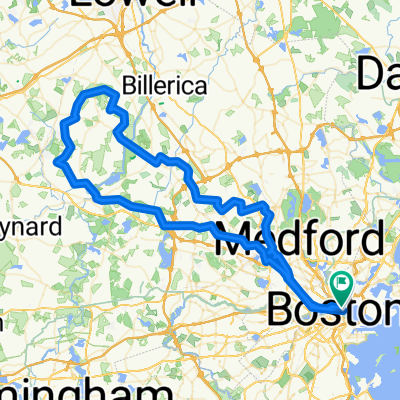
Beacon Hill - Nahant
A cycling route starting in Boston, Massachusetts, United States.
Overview
About this route
- -:--
- Duration
- 55.5 km
- Distance
- 199 m
- Ascent
- 201 m
- Descent
- ---
- Avg. speed
- 17 m
- Max. altitude

Route quality
Waytypes & surfaces along the route
Waytypes
Cycleway
32.7 km
(59 %)
Road
3.9 km
(7 %)
Surfaces
Paved
52.7 km
(95 %)
Asphalt
49.9 km
(90 %)
Concrete
2.8 km
(5 %)
Undefined
2.8 km
(5 %)
Continue with Bikemap
Use, edit, or download this cycling route
You would like to ride Beacon Hill - Nahant or customize it for your own trip? Here is what you can do with this Bikemap route:
Free features
- Save this route as favorite or in collections
- Copy & plan your own version of this route
- Sync your route with Garmin or Wahoo
Premium features
Free trial for 3 days, or one-time payment. More about Bikemap Premium.
- Navigate this route on iOS & Android
- Export a GPX / KML file of this route
- Create your custom printout (try it for free)
- Download this route for offline navigation
Discover more Premium features.
Get Bikemap PremiumFrom our community
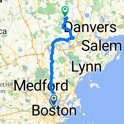
Other popular routes starting in Boston
 ride through Cambridge
- Distance
- 20.8 km
- Ascent
- 98 m
- Descent
- 97 m
- Location
- Boston, Massachusetts, United States
 Moderate Sunday Track In Cambridge
- Distance
- 16.6 km
- Ascent
- 294 m
- Descent
- 296 m
- Location
- Boston, Massachusetts, United States
 UA Great Brook Farm
- Distance
- 100.4 km
- Ascent
- 838 m
- Descent
- 836 m
- Location
- Boston, Massachusetts, United States

Edge 820®
Boston Cycling- Distance
- 42.7 km
- Ascent
- 313 m
- Descent
- 254 m
- Location
- Boston, Massachusetts, United States
 Northend to Fenway 2
- Distance
- 15.2 km
- Ascent
- 205 m
- Descent
- 205 m
- Location
- Boston, Massachusetts, United States
 Loop to the pond
- Distance
- 34.1 km
- Ascent
- 351 m
- Descent
- 356 m
- Location
- Boston, Massachusetts, United States
 Water St, Boston to Lake St, Middleton
- Distance
- 36.9 km
- Ascent
- 222 m
- Descent
- 193 m
- Location
- Boston, Massachusetts, United States
 Minute Man Trail
- Distance
- 44 km
- Ascent
- 175 m
- Descent
- 178 m
- Location
- Boston, Massachusetts, United States
Open it in the app