
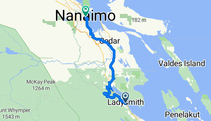
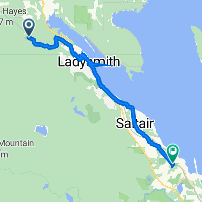
Roberts Street 33, Ladysmith to Terminal Avenue 477, Nanaimo
A cycling route starting in Ladysmith, British Columbia, Canada.
Overview
About this route
- 2 h 17 min
- Duration
- 31.5 km
- Distance
- 462 m
- Ascent
- 498 m
- Descent
- 13.8 km/h
- Avg. speed
- 112 m
- Avg. speed

Route quality
Waytypes & surfaces along the route
Waytypes
Busy road
11.1 km
(35 %)
Quiet road
8.4 km
(27 %)
Surfaces
Paved
24.9 km
(79 %)
Unpaved
2.6 km
(8 %)
Asphalt
14.7 km
(47 %)
Paved (undefined)
10.2 km
(32 %)
Continue with Bikemap
Use, edit, or download this cycling route
You would like to ride Roberts Street 33, Ladysmith to Terminal Avenue 477, Nanaimo or customize it for your own trip? Here is what you can do with this Bikemap route:
Free features
- Save this route as favorite or in collections
- Copy & plan your own version of this route
- Sync your route with Garmin or Wahoo
Premium features
Free trial for 3 days, or one-time payment. More about Bikemap Premium.
- Navigate this route on iOS & Android
- Export a GPX / KML file of this route
- Create your custom printout (try it for free)
- Download this route for offline navigation
Discover more Premium features.
Get Bikemap PremiumFrom our community
Other popular routes starting in Ladysmith
 69–71 Esplanade Ave, Ladysmith to 242–288 Oyster Cove Rd, Ladysmith
- Distance
- 20.8 km
- Ascent
- 4 m
- Descent
- 21 m
- Location
- Ladysmith, British Columbia, Canada
 242–288 Oyster Cove Rd, Ladysmith to 242–288 Oyster Cove Rd, Ladysmith
- Distance
- 0.2 km
- Ascent
- 0 m
- Descent
- 0 m
- Location
- Ladysmith, British Columbia, Canada
 Ladysmith to Alderlea Vineyard
- Distance
- 29.3 km
- Ascent
- 249 m
- Descent
- 248 m
- Location
- Ladysmith, British Columbia, Canada
 return
- Distance
- 21.8 km
- Ascent
- 143 m
- Descent
- 178 m
- Location
- Ladysmith, British Columbia, Canada
 18 High St, Ladysmith to 2432 Cowichan Station Rd, Cowichan Valley
- Distance
- 41.6 km
- Ascent
- 512 m
- Descent
- 518 m
- Location
- Ladysmith, British Columbia, Canada
 15 km Cedar route
- Distance
- 15 km
- Ascent
- 191 m
- Descent
- 184 m
- Location
- Ladysmith, British Columbia, Canada
 Crow and Gate
- Distance
- 12.2 km
- Ascent
- 0 m
- Descent
- 4 m
- Location
- Ladysmith, British Columbia, Canada
 Cedar
Cedar- Distance
- 31.5 km
- Ascent
- 438 m
- Descent
- 477 m
- Location
- Ladysmith, British Columbia, Canada
Open it in the app