

Nova Ves - Karlsbad 85 km
A cycling route starting in Skalná, Karlovarský kraj, Czechia.
Overview
About this route
- -:--
- Duration
- 85 km
- Distance
- 1,196 m
- Ascent
- 907 m
- Descent
- ---
- Avg. speed
- 957 m
- Max. altitude

Route quality
Waytypes & surfaces along the route
Waytypes
Road
28.9 km
(34 %)
Track
22.1 km
(26 %)
Surfaces
Paved
42.5 km
(50 %)
Unpaved
22.1 km
(26 %)
Asphalt
40.8 km
(48 %)
Gravel
19.5 km
(23 %)
Route highlights
Points of interest along the route
Point of interest after 0 km
Zugang Stuibenfälle
Continue with Bikemap
Use, edit, or download this cycling route
You would like to ride Nova Ves - Karlsbad 85 km or customize it for your own trip? Here is what you can do with this Bikemap route:
Free features
- Save this route as favorite or in collections
- Copy & plan your own version of this route
- Split it into stages to create a multi-day tour
- Sync your route with Garmin or Wahoo
Premium features
Free trial for 3 days, or one-time payment. More about Bikemap Premium.
- Navigate this route on iOS & Android
- Export a GPX / KML file of this route
- Create your custom printout (try it for free)
- Download this route for offline navigation
Discover more Premium features.
Get Bikemap PremiumFrom our community
Other popular routes starting in Skalná
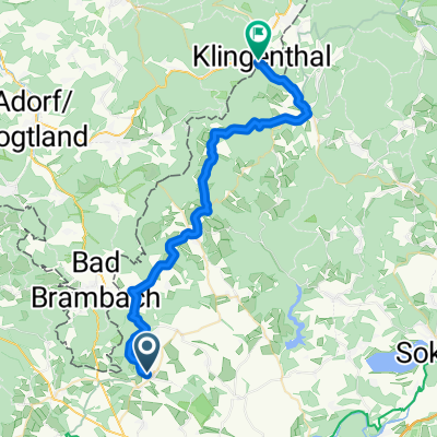 Potoční, Skalná nach Klingenthal, Klingenthal
- Distance
- 36.8 km
- Ascent
- 800 m
- Descent
- 709 m
- Location
- Skalná, Karlovarský kraj, Czechia
 Vojtanov - Frantiskovy Lazne
- Distance
- 41.3 km
- Ascent
- 351 m
- Descent
- 422 m
- Location
- Skalná, Karlovarský kraj, Czechia
 EUTIT TOUR 2017 Cyklo 51 km
- Distance
- 51.4 km
- Ascent
- 553 m
- Descent
- 365 m
- Location
- Skalná, Karlovarský kraj, Czechia
 Kaceřov Třebeň horka Kaceřov
- Distance
- 24.6 km
- Ascent
- 159 m
- Descent
- 162 m
- Location
- Skalná, Karlovarský kraj, Czechia
 Německo 2018: Skalná - Zwickau (Den 1.)
- Distance
- 89.5 km
- Ascent
- 955 m
- Descent
- 1,138 m
- Location
- Skalná, Karlovarský kraj, Czechia
 Nova Ves - Karlsbad 85 km
- Distance
- 85 km
- Ascent
- 1,196 m
- Descent
- 907 m
- Location
- Skalná, Karlovarský kraj, Czechia
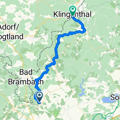 Farní, Skalná nach B283, Klingenthal
- Distance
- 35.2 km
- Ascent
- 676 m
- Descent
- 594 m
- Location
- Skalná, Karlovarský kraj, Czechia
 Kapellenber - Bärendorf - Okruh
- Distance
- 12.6 km
- Ascent
- 324 m
- Descent
- 321 m
- Location
- Skalná, Karlovarský kraj, Czechia
Open it in the app