

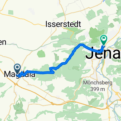
Johannisstraße 21, Magdala nach Göschwitzer Straße 66, Jena
A cycling route starting in Magdala, Thuringia, Germany.
Overview
About this route
- 37 min
- Duration
- 14.2 km
- Distance
- 276 m
- Ascent
- 403 m
- Descent
- 23 km/h
- Avg. speed
- 389 m
- Max. altitude

Route quality
Waytypes & surfaces along the route
Waytypes
Track
8.8 km
(62 %)
Quiet road
2.2 km
(15 %)
Surfaces
Paved
7.9 km
(56 %)
Unpaved
5.3 km
(38 %)
Asphalt
5.5 km
(39 %)
Paved (undefined)
2.4 km
(17 %)
Continue with Bikemap
Use, edit, or download this cycling route
You would like to ride Johannisstraße 21, Magdala nach Göschwitzer Straße 66, Jena or customize it for your own trip? Here is what you can do with this Bikemap route:
Free features
- Save this route as favorite or in collections
- Copy & plan your own version of this route
- Sync your route with Garmin or Wahoo
Premium features
Free trial for 3 days, or one-time payment. More about Bikemap Premium.
- Navigate this route on iOS & Android
- Export a GPX / KML file of this route
- Create your custom printout (try it for free)
- Download this route for offline navigation
Discover more Premium features.
Get Bikemap PremiumFrom our community
Other popular routes starting in Magdala
 Johannisstraße 21, Magdala nach Göschwitzer Straße 66, Jena
- Distance
- 14.2 km
- Ascent
- 276 m
- Descent
- 403 m
- Location
- Magdala, Thuringia, Germany
 Blankenhainer Straße 5D, Magdala nach Göschwitzer Straße 66, Jena
- Distance
- 14.9 km
- Ascent
- 475 m
- Descent
- 606 m
- Location
- Magdala, Thuringia, Germany
 Döbritschen/Vesser
- Distance
- 86.1 km
- Ascent
- 810 m
- Descent
- 508 m
- Location
- Magdala, Thuringia, Germany
 Ottstedter Straße, Magdala nach Dornburger Straße 26, Jena
- Distance
- 14.5 km
- Ascent
- 387 m
- Descent
- 526 m
- Location
- Magdala, Thuringia, Germany
 Ottstedter Straße 7, Magdala nach Göschwitzer Straße 66A, Jena
- Distance
- 14.6 km
- Ascent
- 207 m
- Descent
- 339 m
- Location
- Magdala, Thuringia, Germany
 Route zu Steigerwald Stadium
- Distance
- 37.4 km
- Ascent
- 502 m
- Descent
- 565 m
- Location
- Magdala, Thuringia, Germany
 Magdala nach Marbach_überwiegend Radwege 2
- Distance
- 191.8 km
- Ascent
- 1,201 m
- Descent
- 1,164 m
- Location
- Magdala, Thuringia, Germany
 Ottstedter Straße 7, Magdala nach Göschwitzer Straße 66, Jena
- Distance
- 14.4 km
- Ascent
- 504 m
- Descent
- 635 m
- Location
- Magdala, Thuringia, Germany
Open it in the app