

WT, Aston Clinton, Wendover Woods, Wendover WT
A cycling route starting in Weston Turville, England, United Kingdom.
Overview
About this route
- 2 h 5 min
- Duration
- 16.5 km
- Distance
- 252 m
- Ascent
- 301 m
- Descent
- 7.9 km/h
- Avg. speed
- 300 m
- Max. altitude

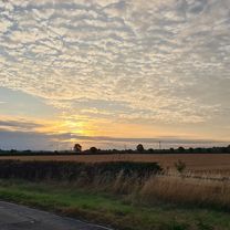
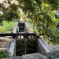
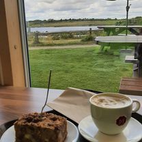
Route photos

Route quality
Waytypes & surfaces along the route
Waytypes
Road
5.3 km
(32 %)
Quiet road
3.8 km
(23 %)
Surfaces
Paved
5.8 km
(35 %)
Unpaved
1.8 km
(11 %)
Asphalt
5.3 km
(32 %)
Gravel
1 km
(6 %)
Continue with Bikemap
Use, edit, or download this cycling route
You would like to ride WT, Aston Clinton, Wendover Woods, Wendover WT or customize it for your own trip? Here is what you can do with this Bikemap route:
Free features
- Save this route as favorite or in collections
- Copy & plan your own version of this route
- Sync your route with Garmin or Wahoo
Premium features
Free trial for 3 days, or one-time payment. More about Bikemap Premium.
- Navigate this route on iOS & Android
- Export a GPX / KML file of this route
- Create your custom printout (try it for free)
- Download this route for offline navigation
Discover more Premium features.
Get Bikemap PremiumFrom our community
Other popular routes starting in Weston Turville
 WT, Longwick, Phoenix Trail, Towersey, Kimble, WT
- Distance
- 41.2 km
- Ascent
- 347 m
- Descent
- 397 m
- Location
- Weston Turville, England, United Kingdom
 WT, Kingsbrook, GU canal path, AC, WT
- Distance
- 22 km
- Ascent
- 119 m
- Descent
- 161 m
- Location
- Weston Turville, England, United Kingdom
 Weston Turville -Tring 20k early morning loop
- Distance
- 21.2 km
- Ascent
- 96 m
- Descent
- 142 m
- Location
- Weston Turville, England, United Kingdom
 WT, AC, Puttenham, Marsworth, College Lake and back
- Distance
- 30.4 km
- Ascent
- 174 m
- Descent
- 226 m
- Location
- Weston Turville, England, United Kingdom
 WT, Watermead, Oving, Wingrave, Marsworth, College Lake, WT
- Distance
- 53 km
- Ascent
- 493 m
- Descent
- 540 m
- Location
- Weston Turville, England, United Kingdom
 WT, Watermead, Claydon House
- Distance
- 37.9 km
- Ascent
- 293 m
- Descent
- 341 m
- Location
- Weston Turville, England, United Kingdom
 WT, Aston Clinton, Wendover Woods, Wendover WT
- Distance
- 16.5 km
- Ascent
- 252 m
- Descent
- 301 m
- Location
- Weston Turville, England, United Kingdom
 WT, Dancers End, Tring, Wiggington, Northchurch, Ashridge, Ivinghoe, WT
- Distance
- 49 km
- Ascent
- 800 m
- Descent
- 800 m
- Location
- Weston Turville, England, United Kingdom
Open it in the app