Waldstraße 3, Eisfeld nach Waldstraße 1, Eisfeld
- 31.6 km
- 916 m
- 919 m
- Eisfeld, Thuringia, Germany
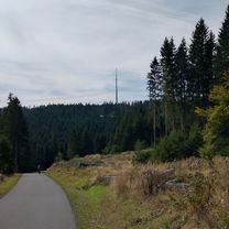
A cycling route starting in Eisfeld, Thuringia, Germany.
Overview
Brattendorf - Masserberg - Neustadt a. Rennweg - Gehren - Ilmenau - Fraunwald - Oberrod - Widersbach - Brattendorf
Extremely demanding mountain tour. Once from south to north over the crest of the Thuringian Forest and back. Mostly side roads through the forest.
created this 17 years ago
Route quality
Road
24.9 km
(30 %)
Quiet road
10.8 km
(13 %)
Paved
68.8 km
(83 %)
Unpaved
2.5 km
(3 %)
Asphalt
67.9 km
(82 %)
Ground
1.7 km
(2 %)
Continue with Bikemap
You would like to ride Über den Thüringer Wald or customize it for your own trip? Here is what you can do with this Bikemap route:
Free trial for 3 days, or one-time payment. More about Bikemap Premium.
Discover more Premium features.
Get Bikemap PremiumFrom our community
Open it in the app