

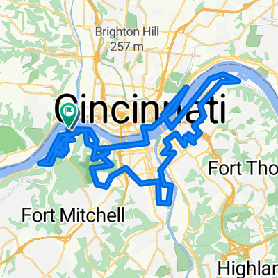
Hopple St. to Harrison HS
A cycling route starting in Ludlow, Kentucky, United States.
Overview
About this route
- -:--
- Duration
- 28.4 km
- Distance
- 231 m
- Ascent
- 217 m
- Descent
- ---
- Avg. speed
- ---
- Max. altitude
Continue with Bikemap
Use, edit, or download this cycling route
You would like to ride Hopple St. to Harrison HS or customize it for your own trip? Here is what you can do with this Bikemap route:
Free features
- Save this route as favorite or in collections
- Copy & plan your own version of this route
- Sync your route with Garmin or Wahoo
Premium features
Free trial for 3 days, or one-time payment. More about Bikemap Premium.
- Navigate this route on iOS & Android
- Export a GPX / KML file of this route
- Create your custom printout (try it for free)
- Download this route for offline navigation
Discover more Premium features.
Get Bikemap PremiumFrom our community
Other popular routes starting in Ludlow
 Ride to Riverview Cyclocross race
- Distance
- 36.6 km
- Ascent
- 225 m
- Descent
- 286 m
- Location
- Ludlow, Kentucky, United States
 Music Hall to Lunken Loop and Return
- Distance
- 35.3 km
- Ascent
- 185 m
- Descent
- 187 m
- Location
- Ludlow, Kentucky, United States
 106 Ash St, Ludlow to 301–387 Dave Cowens Dr, Newport
- Distance
- 6.5 km
- Ascent
- 68 m
- Descent
- 71 m
- Location
- Ludlow, Kentucky, United States
 Hopple St. to Harrison HS
- Distance
- 28.4 km
- Ascent
- 231 m
- Descent
- 217 m
- Location
- Ludlow, Kentucky, United States
 River Ride_25 0927
- Distance
- 54 km
- Ascent
- 510 m
- Descent
- 512 m
- Location
- Ludlow, Kentucky, United States
 Findlay to Lunken and Return
- Distance
- 27.6 km
- Ascent
- 70 m
- Descent
- 70 m
- Location
- Ludlow, Kentucky, United States
 Findlay Market to Mt. Adams
- Distance
- 3.8 km
- Ascent
- 102 m
- Descent
- 28 m
- Location
- Ludlow, Kentucky, United States
 2364 W McMicken Ave, Cincinnati to 131 E Broadway St, Loveland
- Distance
- 44.1 km
- Ascent
- 326 m
- Descent
- 321 m
- Location
- Ludlow, Kentucky, United States
Open it in the app