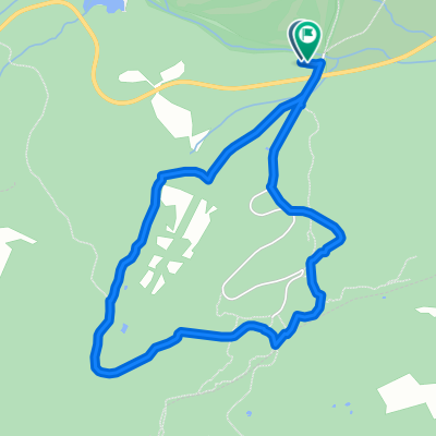
Abantose-bike
- 26.8 km
- 1,432 m
- 1,432 m
- El Escorial, Madrid, Spain
A cycling route starting in El Escorial, Madrid, Spain.
Overview
First attempt to climb Abantos. The route is not complete and there is a detour along a dead-end road. Nice route but with a continuous and steep climb from the very beginning. The best part is the final descent and the views of the entire Community of Madrid.
created this 14 years ago
Route highlights
El camino de frente lleva a una zona sin salida. El camino de la derecha le tomamos y llegamos a la subida a Abantos
Aquí teníamos al toro blanco que estaba vigilando el camino
Zona sin salida
Continue with Bikemap
You would like to ride Subida a Abantos or customize it for your own trip? Here is what you can do with this Bikemap route:
Free trial for 3 days, or one-time payment. More about Bikemap Premium.
Discover more Premium features.
Get Bikemap PremiumFrom our community
Open it in the app