

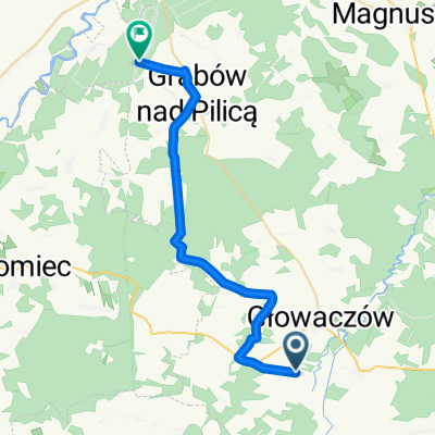
Kozłów, Jastrzębia do Romana Szczawińskiego 2, Radom
A cycling route starting in Jastrzębia, Masovian Voivodeship, Poland.
Overview
About this route
- 1 h 32 min
- Duration
- 17.9 km
- Distance
- 111 m
- Ascent
- 122 m
- Descent
- 11.7 km/h
- Avg. speed
- 178 m
- Max. altitude

Route quality
Waytypes & surfaces along the route
Waytypes
Quiet road
6.4 km
(36 %)
Track
5.9 km
(33 %)
Surfaces
Paved
8.8 km
(49 %)
Unpaved
2.9 km
(16 %)
Asphalt
8.8 km
(49 %)
Gravel
1.8 km
(10 %)
Continue with Bikemap
Use, edit, or download this cycling route
You would like to ride Kozłów, Jastrzębia do Romana Szczawińskiego 2, Radom or customize it for your own trip? Here is what you can do with this Bikemap route:
Free features
- Save this route as favorite or in collections
- Copy & plan your own version of this route
- Sync your route with Garmin or Wahoo
Premium features
Free trial for 3 days, or one-time payment. More about Bikemap Premium.
- Navigate this route on iOS & Android
- Export a GPX / KML file of this route
- Create your custom printout (try it for free)
- Download this route for offline navigation
Discover more Premium features.
Get Bikemap PremiumFrom our community
Other popular routes starting in Jastrzębia
 Kozłów, Jastrzębia do Romana Szczawińskiego 2, Radom
- Distance
- 17.9 km
- Ascent
- 111 m
- Descent
- 122 m
- Location
- Jastrzębia, Masovian Voivodeship, Poland
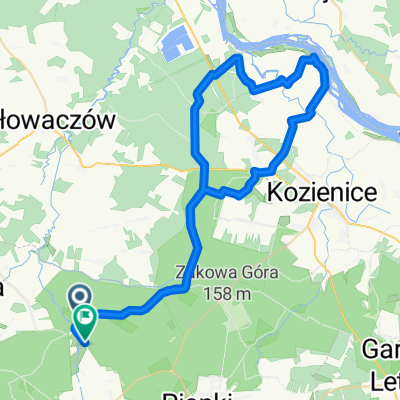
 Lesiów - Czarnolas - szlak rowerowy
- Distance
- 51.9 km
- Ascent
- 206 m
- Descent
- 181 m
- Location
- Jastrzębia, Masovian Voivodeship, Poland
 44A do Grabów n. Pilicą
- Distance
- 25.9 km
- Ascent
- 249 m
- Descent
- 260 m
- Location
- Jastrzębia, Masovian Voivodeship, Poland
 Jazda z miasta! Do Muzeum Witolda Gombrowicza we Wsoli
- Distance
- 19.2 km
- Ascent
- 58 m
- Descent
- 67 m
- Location
- Jastrzębia, Masovian Voivodeship, Poland
 Jaroszki, Pionki do Jaroszki, Pionki
- Distance
- 60.6 km
- Ascent
- 1,171 m
- Descent
- 1,176 m
- Location
- Jastrzębia, Masovian Voivodeship, Poland
 Gran Wydmy
- Distance
- 10.7 km
- Ascent
- 42 m
- Descent
- 41 m
- Location
- Jastrzębia, Masovian Voivodeship, Poland
 Gran wydmy
- Distance
- 12 km
- Ascent
- 35 m
- Descent
- 35 m
- Location
- Jastrzębia, Masovian Voivodeship, Poland
 2018-10-31
- Distance
- 48.5 km
- Ascent
- 123 m
- Descent
- 119 m
- Location
- Jastrzębia, Masovian Voivodeship, Poland
Open it in the app