

Murg-Betlis (Seeuferweg Teil1)
A cycling route starting in Quarten, Canton of St. Gallen, Switzerland.
Overview
About this route
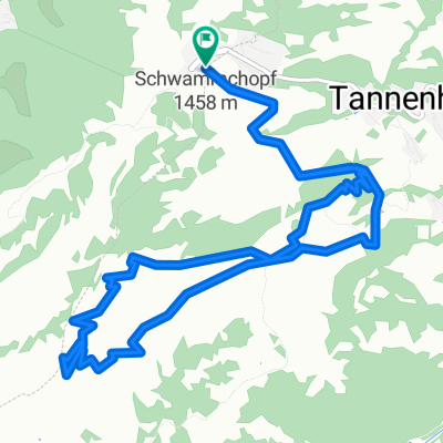
<p>Murg Camping - Mühlehorn-Weesen-Betlis Schifflände</p>
Translated, show original (German)- -:--
- Duration
- 15.4 km
- Distance
- 531 m
- Ascent
- 529 m
- Descent
- ---
- Avg. speed
- 586 m
- Max. altitude

Route quality
Waytypes & surfaces along the route
Waytypes
Quiet road
6.2 km
(40 %)
Access road
3.2 km
(21 %)
Surfaces
Paved
13.6 km
(88 %)
Unpaved
1.5 km
(10 %)
Asphalt
12.5 km
(81 %)
Gravel
1.5 km
(10 %)
Continue with Bikemap
Use, edit, or download this cycling route
You would like to ride Murg-Betlis (Seeuferweg Teil1) or customize it for your own trip? Here is what you can do with this Bikemap route:
Free features
- Save this route as favorite or in collections
- Copy & plan your own version of this route
- Sync your route with Garmin or Wahoo
Premium features
Free trial for 3 days, or one-time payment. More about Bikemap Premium.
- Navigate this route on iOS & Android
- Export a GPX / KML file of this route
- Create your custom printout (try it for free)
- Download this route for offline navigation
Discover more Premium features.
Get Bikemap PremiumFrom our community
Other popular routes starting in Quarten
 Murg-Betlis (Seeuferweg Teil1)
- Distance
- 15.4 km
- Ascent
- 531 m
- Descent
- 529 m
- Location
- Quarten, Canton of St. Gallen, Switzerland
 Panorama Bike mit Talfahrt
- Distance
- 26.5 km
- Ascent
- 673 m
- Descent
- 1,637 m
- Location
- Quarten, Canton of St. Gallen, Switzerland
 Unterterzen-Maschgenkamm-Glarus
- Distance
- 61 km
- Ascent
- 2,275 m
- Descent
- 2,277 m
- Location
- Quarten, Canton of St. Gallen, Switzerland
 Flumserberg-Tannenbodenalp-Brodkamm-Tannenbodenalp
- Distance
- 12.6 km
- Ascent
- 567 m
- Descent
- 565 m
- Location
- Quarten, Canton of St. Gallen, Switzerland
 A03 Tannenboden Maschgenkamm
- Distance
- 17.1 km
- Ascent
- 676 m
- Descent
- 676 m
- Location
- Quarten, Canton of St. Gallen, Switzerland
 Flumserberg, Tannenboden via Seebenalp via Maschgenkamm via Prodalp via Tannenboden nach Unterterzen Seejet
- Distance
- 25.5 km
- Ascent
- 1,489 m
- Descent
- 2,371 m
- Location
- Quarten, Canton of St. Gallen, Switzerland
 12. Murg-Baden-106km-1150Hm
- Distance
- 115.8 km
- Ascent
- 1,633 m
- Descent
- 1,678 m
- Location
- Quarten, Canton of St. Gallen, Switzerland
 120428_Walensee
- Distance
- 17.7 km
- Ascent
- 734 m
- Descent
- 743 m
- Location
- Quarten, Canton of St. Gallen, Switzerland
Open it in the app