

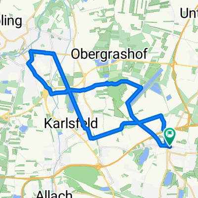
Dachauer Hinterland 80km
A cycling route starting in Oberschleißheim, Bavaria, Germany.
Overview
About this route
...suitable for a bike ride - Break at Tafernwirtschaft km40
- -:--
- Duration
- 74.3 km
- Distance
- 360 m
- Ascent
- 382 m
- Descent
- ---
- Avg. speed
- 540 m
- Max. altitude
Route quality
Waytypes & surfaces along the route
Waytypes
Road
20.1 km
(27 %)
Quiet road
12.6 km
(17 %)
Surfaces
Paved
50.5 km
(68 %)
Unpaved
3 km
(4 %)
Asphalt
49.8 km
(67 %)
Gravel
1.5 km
(2 %)
Continue with Bikemap
Use, edit, or download this cycling route
You would like to ride Dachauer Hinterland 80km or customize it for your own trip? Here is what you can do with this Bikemap route:
Free features
- Save this route as favorite or in collections
- Copy & plan your own version of this route
- Sync your route with Garmin or Wahoo
Premium features
Free trial for 3 days, or one-time payment. More about Bikemap Premium.
- Navigate this route on iOS & Android
- Export a GPX / KML file of this route
- Create your custom printout (try it for free)
- Download this route for offline navigation
Discover more Premium features.
Get Bikemap PremiumFrom our community
Other popular routes starting in Oberschleißheim
 Oberschleißheim, Oberschleißheim nach Gröbmühlstraße, Dachau
- Distance
- 10.1 km
- Ascent
- 21 m
- Descent
- 16 m
- Location
- Oberschleißheim, Bavaria, Germany
 Rundkurs Münchner Norden
- Distance
- 29.5 km
- Ascent
- 8 m
- Descent
- 9 m
- Location
- Oberschleißheim, Bavaria, Germany
 Stadtführung München, Radtour Nord vom Schloss Schleißheim zur Allianz-Arena von www.stadtspiele-verlag.de
- Distance
- 9.9 km
- Ascent
- 24 m
- Descent
- 14 m
- Location
- Oberschleißheim, Bavaria, Germany
 Muc_Ingolstadt
- Distance
- 81.7 km
- Ascent
- 538 m
- Descent
- 641 m
- Location
- Oberschleißheim, Bavaria, Germany
 Vierkirchener Runde
- Distance
- 44.6 km
- Ascent
- 103 m
- Descent
- 103 m
- Location
- Oberschleißheim, Bavaria, Germany
 First ride July 30, 15:35
- Distance
- 38.7 km
- Ascent
- 18 m
- Descent
- 21 m
- Location
- Oberschleißheim, Bavaria, Germany
 RSGT Isartour 2015 - Stadtrundfahrt München
- Distance
- 45.1 km
- Ascent
- 46 m
- Descent
- 46 m
- Location
- Oberschleißheim, Bavaria, Germany
 Ausfahrt durch München
- Distance
- 22 km
- Ascent
- 11 m
- Descent
- 12 m
- Location
- Oberschleißheim, Bavaria, Germany
Open it in the app