

Timmy´s Trailorgie Teil 1
A cycling route starting in Höchberg, Bavaria, Germany.
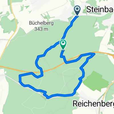
Overview
About this route
- -:--
- Duration
- 13.7 km
- Distance
- 257 m
- Ascent
- 138 m
- Descent
- ---
- Avg. speed
- ---
- Max. altitude
Continue with Bikemap
Use, edit, or download this cycling route
You would like to ride Timmy´s Trailorgie Teil 1 or customize it for your own trip? Here is what you can do with this Bikemap route:
Free features
- Save this route as favorite or in collections
- Copy & plan your own version of this route
- Sync your route with Garmin or Wahoo
Premium features
Free trial for 3 days, or one-time payment. More about Bikemap Premium.
- Navigate this route on iOS & Android
- Export a GPX / KML file of this route
- Create your custom printout (try it for free)
- Download this route for offline navigation
Discover more Premium features.
Get Bikemap PremiumFrom our community
Other popular routes starting in Höchberg
 Nürnberg - Koblenz Etappe 6/13
- Distance
- 43.5 km
- Ascent
- 56 m
- Descent
- 64 m
- Location
- Höchberg, Bavaria, Germany
 Würzburg-Aschaffenburg, Mainradweg
- Distance
- 131.2 km
- Ascent
- 328 m
- Descent
- 406 m
- Location
- Höchberg, Bavaria, Germany
 2-Romantische-Straße-Hohenpeißenberg
- Distance
- 333.5 km
- Ascent
- 1,081 m
- Descent
- 614 m
- Location
- Höchberg, Bavaria, Germany
 Timmy´s Trailorgie Teil 1
- Distance
- 13.7 km
- Ascent
- 257 m
- Descent
- 138 m
- Location
- Höchberg, Bavaria, Germany
 2016 - 2. Tag
- Distance
- 98.3 km
- Ascent
- 217 m
- Descent
- 360 m
- Location
- Höchberg, Bavaria, Germany
 Schwanberg
- Distance
- 81.3 km
- Ascent
- 597 m
- Descent
- 592 m
- Location
- Höchberg, Bavaria, Germany
 Lange Runde
- Distance
- 111.9 km
- Ascent
- 538 m
- Descent
- 520 m
- Location
- Höchberg, Bavaria, Germany
 Kripo Radtour 2014 - 1. Tag
- Distance
- 51.2 km
- Ascent
- 179 m
- Descent
- 166 m
- Location
- Höchberg, Bavaria, Germany
Open it in the app