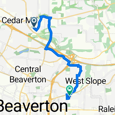
The route I did 6/27/23
A cycling route starting in Cedar Mill, Oregon, United States.
Overview
About this route
Pretty easy, only the last mile or so were any big issue.
- -:--
- Duration
- 20.6 km
- Distance
- 215 m
- Ascent
- 217 m
- Descent
- ---
- Avg. speed
- 127 m
- Max. altitude
Route quality
Waytypes & surfaces along the route
Waytypes
Path
10.1 km
(49 %)
Quiet road
4.3 km
(21 %)
Surfaces
Paved
17.1 km
(83 %)
Paved (undefined)
8.7 km
(42 %)
Asphalt
7.6 km
(37 %)
Continue with Bikemap
Use, edit, or download this cycling route
You would like to ride The route I did 6/27/23 or customize it for your own trip? Here is what you can do with this Bikemap route:
Free features
- Save this route as favorite or in collections
- Copy & plan your own version of this route
- Sync your route with Garmin or Wahoo
Premium features
Free trial for 3 days, or one-time payment. More about Bikemap Premium.
- Navigate this route on iOS & Android
- Export a GPX / KML file of this route
- Create your custom printout (try it for free)
- Download this route for offline navigation
Discover more Premium features.
Get Bikemap PremiumFrom our community
Other popular routes starting in Cedar Mill
The route I did 6/27/23- Distance
- 20.6 km
- Ascent
- 215 m
- Descent
- 217 m
- Location
- Cedar Mill, Oregon, United States
[39]Tigard-Schools-Orenco- Distance
- 62.1 km
- Ascent
- 224 m
- Descent
- 224 m
- Location
- Cedar Mill, Oregon, United States
13.8 Flat- Distance
- 22.3 km
- Ascent
- 203 m
- Descent
- 203 m
- Location
- Cedar Mill, Oregon, United States
jake's PITA route 6/28/23- Distance
- 25.5 km
- Ascent
- 286 m
- Descent
- 287 m
- Location
- Cedar Mill, Oregon, United States
[77]Laurel-FG-NPlains- Distance
- 124.6 km
- Ascent
- 561 m
- Descent
- 561 m
- Location
- Cedar Mill, Oregon, United States
Route from Northwest Lost Springs Terrace 385, Portland- Distance
- 7.3 km
- Ascent
- 105 m
- Descent
- 108 m
- Location
- Cedar Mill, Oregon, United States
Cedar Mill, Hillsboro Airport, Rock Creek- Distance
- 29.4 km
- Ascent
- 177 m
- Descent
- 177 m
- Location
- Cedar Mill, Oregon, United States
12.42- Distance
- 21.4 km
- Ascent
- 363 m
- Descent
- 365 m
- Location
- Cedar Mill, Oregon, United States
Open it in the app

