
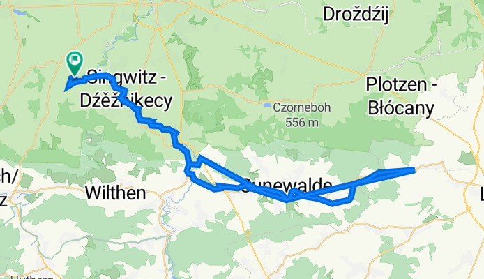
Siedlungsstraße 17, Doberschau-Gaußig nach Siedlungsstraße 13, Doberschau-Gaußig
A cycling route starting in Obergurig, Saxony, Germany.
Overview
About this route
- 2 h 59 min
- Duration
- 46.4 km
- Distance
- 375 m
- Ascent
- 410 m
- Descent
- 15.5 km/h
- Avg. speed
- 380 m
- Max. altitude

Route quality
Waytypes & surfaces along the route
Waytypes
Path
18.6 km
(40 %)
Access road
10.7 km
(23 %)
Surfaces
Paved
41.9 km
(90 %)
Unpaved
1.2 km
(3 %)
Asphalt
32.9 km
(71 %)
Paving stones
4.6 km
(10 %)
Continue with Bikemap
Use, edit, or download this cycling route
You would like to ride Siedlungsstraße 17, Doberschau-Gaußig nach Siedlungsstraße 13, Doberschau-Gaußig or customize it for your own trip? Here is what you can do with this Bikemap route:
Free features
- Save this route as favorite or in collections
- Copy & plan your own version of this route
- Sync your route with Garmin or Wahoo
Premium features
Free trial for 3 days, or one-time payment. More about Bikemap Premium.
- Navigate this route on iOS & Android
- Export a GPX / KML file of this route
- Create your custom printout (try it for free)
- Download this route for offline navigation
Discover more Premium features.
Get Bikemap PremiumFrom our community
Other popular routes starting in Obergurig
 Mönchswalder Berg - Czorneboh
- Distance
- 50.6 km
- Ascent
- 1,055 m
- Descent
- 1,055 m
- Location
- Obergurig, Saxony, Germany
 Hochstein (Königshainer Berge)
- Distance
- 89.3 km
- Ascent
- 657 m
- Descent
- 657 m
- Location
- Obergurig, Saxony, Germany
 Hunderunde 01
- Distance
- 4.4 km
- Ascent
- 60 m
- Descent
- 61 m
- Location
- Obergurig, Saxony, Germany
 Route von und nach Siedlungsstraße 13, Doberschau-Gaußig
- Distance
- 42.9 km
- Ascent
- 343 m
- Descent
- 342 m
- Location
- Obergurig, Saxony, Germany
 Sechs-und-ein-halb-Hügel-Runde
- Distance
- 89.1 km
- Ascent
- 1,342 m
- Descent
- 1,342 m
- Location
- Obergurig, Saxony, Germany
 Bautzener Oberland Runde 2012 I
- Distance
- 43.7 km
- Ascent
- 928 m
- Descent
- 928 m
- Location
- Obergurig, Saxony, Germany
 Gr. Picho - Valtenberg - Prz.-Frdr.-August-Höhe - Sohland / Spr.
- Distance
- 47.5 km
- Ascent
- 977 m
- Descent
- 977 m
- Location
- Obergurig, Saxony, Germany
 Mehltheuer
- Distance
- 20.2 km
- Ascent
- 247 m
- Descent
- 247 m
- Location
- Obergurig, Saxony, Germany
Open it in the app