

Saint-Sernin-sur-Rance - Circle through Pousthomy
A cycling route starting in Belmont-sur-Rance, Occitanie, France.
Overview
About this route
Outstanding short ride on D33 from St-Sernin to Pousthomy and on D589 to D999. D999 was all descent. D33 and D589 were excellent scenic low/zero traffic roads. As D999, a major road, was all descent with little traffic, it was fine. Also, it was quite a descent: 5km at 8%.
At the point where D589 meets D999 is the border between the Aveyron and Tarn departments.
We highly recommend this short circle.
- 1 h 52 min
- Duration
- 20.8 km
- Distance
- 519 m
- Ascent
- 514 m
- Descent
- 11.2 km/h
- Avg. speed
- 740 m
- Max. altitude

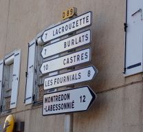
Route photos


Route quality
Waytypes & surfaces along the route
Waytypes
Road
7.3 km
(35 %)
Pedestrian area
0.2 km
(1 %)
Undefined
13.3 km
(64 %)
Surfaces
Paved
7.7 km
(37 %)
Asphalt
7.7 km
(37 %)
Undefined
13.1 km
(63 %)
Continue with Bikemap
Use, edit, or download this cycling route
You would like to ride Saint-Sernin-sur-Rance - Circle through Pousthomy or customize it for your own trip? Here is what you can do with this Bikemap route:
Free features
- Save this route as favorite or in collections
- Copy & plan your own version of this route
- Sync your route with Garmin or Wahoo
Premium features
Free trial for 3 days, or one-time payment. More about Bikemap Premium.
- Navigate this route on iOS & Android
- Export a GPX / KML file of this route
- Create your custom printout (try it for free)
- Download this route for offline navigation
Discover more Premium features.
Get Bikemap PremiumFrom our community
Other popular routes starting in Belmont-sur-Rance
 etape 3
- Distance
- 88.4 km
- Ascent
- ---
- Descent
- ---
- Location
- Belmont-sur-Rance, Occitanie, France
 Combret (La Loubière) to Castres
- Distance
- 75.3 km
- Ascent
- 827 m
- Descent
- 1,217 m
- Location
- Belmont-sur-Rance, Occitanie, France
 Saint-Sernin-sur-Rance to Albi
- Distance
- 53.1 km
- Ascent
- 1,067 m
- Descent
- 1,167 m
- Location
- Belmont-sur-Rance, Occitanie, France
 De Saint-Sever 181, Saint-Sever-du-Moustier à Saint-Sever 181, Saint-Sever-du-Moustier
- Distance
- 47.4 km
- Ascent
- 1,195 m
- Descent
- 1,198 m
- Location
- Belmont-sur-Rance, Occitanie, France
 Tour de France 2011 - Etappe 10 - Belmont-sur-Rance - Nimes
- Distance
- 178.8 km
- Ascent
- 1,053 m
- Descent
- 1,490 m
- Location
- Belmont-sur-Rance, Occitanie, France
 Saint-Sernin-sur-Rance - Circle through Pousthomy
- Distance
- 20.8 km
- Ascent
- 519 m
- Descent
- 514 m
- Location
- Belmont-sur-Rance, Occitanie, France
 La Loubière-Combret - Circle to Lacaune
- Distance
- 42.2 km
- Ascent
- 905 m
- Descent
- 906 m
- Location
- Belmont-sur-Rance, Occitanie, France
 Belmont-sur-Rance - La Salvetat-sur-Agout
- Distance
- 46.8 km
- Ascent
- 910 m
- Descent
- 639 m
- Location
- Belmont-sur-Rance, Occitanie, France
Open it in the app