

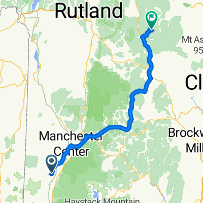
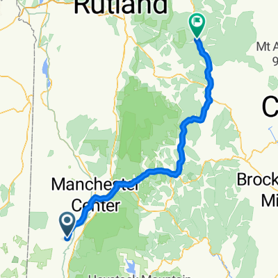
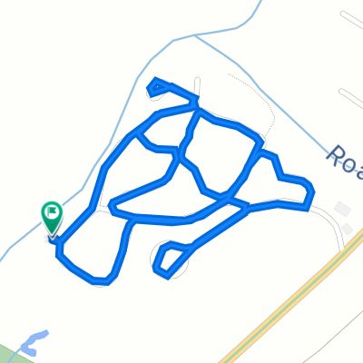
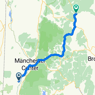
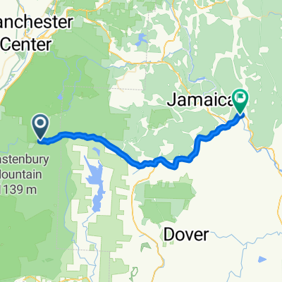
98 Camping on the Battenkill, Arlington to 98 Camping on the Battenkill, Arlington
A cycling route starting in Arlington, Vermont, United States of America.
Overview
About this route
- 17 min
- Duration
- 2.7 km
- Distance
- 19 m
- Ascent
- 20 m
- Descent
- 9.6 km/h
- Avg. speed
- 200 m
- Max. altitude
Route quality
Waytypes & surfaces along the route
Waytypes
Access road
2.7 km
(100 %)
Surfaces
Unpaved
2.7 km
(100 %)
Unpaved (undefined)
2.7 km
(100 %)
Continue with Bikemap
Use, edit, or download this cycling route
You would like to ride 98 Camping on the Battenkill, Arlington to 98 Camping on the Battenkill, Arlington or customize it for your own trip? Here is what you can do with this Bikemap route:
Free features
- Save this route as favorite or in collections
- Copy & plan your own version of this route
- Sync your route with Garmin or Wahoo
Premium features
Free trial for 3 days, or one-time payment. More about Bikemap Premium.
- Navigate this route on iOS & Android
- Export a GPX / KML file of this route
- Create your custom printout (try it for free)
- Download this route for offline navigation
Discover more Premium features.
Get Bikemap PremiumFrom our community
Other popular routes starting in Arlington
 Lac Placide Jour 4b
- Distance
- 85.7 km
- Ascent
- 1,147 m
- Descent
- 831 m
- Location
- Arlington, Vermont, United States of America
 USBR 7: Arlington to Williamstown
- Distance
- 43.5 km
- Ascent
- 535 m
- Descent
- 576 m
- Location
- Arlington, Vermont, United States of America
 Lac Placide jour 4
- Distance
- 80.5 km
- Ascent
- 1,019 m
- Descent
- 830 m
- Location
- Arlington, Vermont, United States of America
 98 Camping on the Battenkill, Arlington to 98 Camping on the Battenkill, Arlington
- Distance
- 2.7 km
- Ascent
- 19 m
- Descent
- 20 m
- Location
- Arlington, Vermont, United States of America
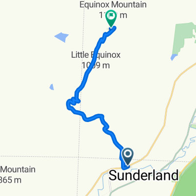 Equinox Mountain
- Distance
- 8.8 km
- Ascent
- 1,001 m
- Descent
- 37 m
- Location
- Arlington, Vermont, United States of America
 Lac Placide Jour 4a
- Distance
- 73.1 km
- Ascent
- 999 m
- Descent
- 832 m
- Location
- Arlington, Vermont, United States of America
 Kelly stand
- Distance
- 37.8 km
- Ascent
- 183 m
- Descent
- 740 m
- Location
- Arlington, Vermont, United States of America
Open it in the app