

jop/Meto/mm_IVV
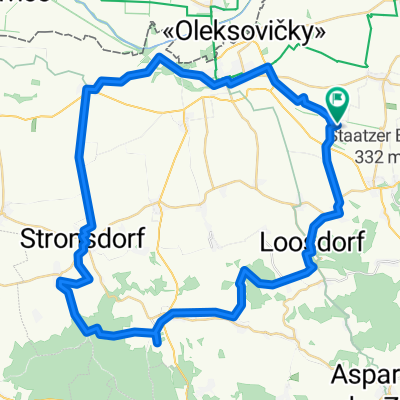
A cycling route starting in Neudorf im Weinviertel, Lower Austria, Austria.
Overview
About this route
- -:--
- Duration
- 181 km
- Distance
- 2,207 m
- Ascent
- 2,218 m
- Descent
- ---
- Avg. speed
- 442 m
- Max. altitude

Route quality
Waytypes & surfaces along the route
Waytypes
Road
52.5 km
(29 %)
Quiet road
50.7 km
(28 %)
Surfaces
Paved
101.3 km
(56 %)
Unpaved
21.7 km
(12 %)
Asphalt
94.1 km
(52 %)
Gravel
14.5 km
(8 %)
Continue with Bikemap
Use, edit, or download this cycling route
You would like to ride jop/Meto/mm_IVV or customize it for your own trip? Here is what you can do with this Bikemap route:
Free features
- Save this route as favorite or in collections
- Copy & plan your own version of this route
- Split it into stages to create a multi-day tour
- Sync your route with Garmin or Wahoo
Premium features
Free trial for 3 days, or one-time payment. More about Bikemap Premium.
- Navigate this route on iOS & Android
- Export a GPX / KML file of this route
- Create your custom printout (try it for free)
- Download this route for offline navigation
Discover more Premium features.
Get Bikemap PremiumFrom our community
Other popular routes starting in Neudorf im Weinviertel
 Landmann-Nordumfahrung echt
- Distance
- 42.6 km
- Ascent
- 392 m
- Descent
- 392 m
- Location
- Neudorf im Weinviertel, Lower Austria, Austria
 Hallo Nachbar
- Distance
- 56.6 km
- Ascent
- 143 m
- Descent
- 143 m
- Location
- Neudorf im Weinviertel, Lower Austria, Austria
 Kottingneusiedl nach Kottingneusiedl
- Distance
- 54.7 km
- Ascent
- 478 m
- Descent
- 480 m
- Location
- Neudorf im Weinviertel, Lower Austria, Austria
 Neudorf - Buschberg
- Distance
- 25.6 km
- Ascent
- 392 m
- Descent
- 170 m
- Location
- Neudorf im Weinviertel, Lower Austria, Austria
 Kleine Weinviertel Runde
- Distance
- 56 km
- Ascent
- 441 m
- Descent
- 403 m
- Location
- Neudorf im Weinviertel, Lower Austria, Austria
 Buschberg
- Distance
- 63.7 km
- Ascent
- 449 m
- Descent
- 447 m
- Location
- Neudorf im Weinviertel, Lower Austria, Austria
 Wüdü-Falkenstein-Poysdorf-Neudorf-Wüdü
- Distance
- 47.2 km
- Ascent
- 364 m
- Descent
- 364 m
- Location
- Neudorf im Weinviertel, Lower Austria, Austria
 Kottingneusiedl Bahnhof to Bahnhof Enzersdorf 2
- Distance
- 55.8 km
- Ascent
- 619 m
- Descent
- 578 m
- Location
- Neudorf im Weinviertel, Lower Austria, Austria
Open it in the app