

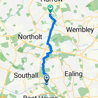
Quietway 16, Southall to Jurys Inn, 31-35 Clarendon Road, Watford
A cycling route starting in Southall, England, United Kingdom.
Overview
About this route
- 5 h 26 min
- Duration
- 28.9 km
- Distance
- 213 m
- Ascent
- 171 m
- Descent
- 5.3 km/h
- Avg. speed
- 86 m
- Max. altitude

Continue with Bikemap
Use, edit, or download this cycling route
You would like to ride Quietway 16, Southall to Jurys Inn, 31-35 Clarendon Road, Watford or customize it for your own trip? Here is what you can do with this Bikemap route:
Free features
- Save this route as favorite or in collections
- Copy & plan your own version of this route
- Sync your route with Garmin or Wahoo
Premium features
Free trial for 3 days, or one-time payment. More about Bikemap Premium.
- Navigate this route on iOS & Android
- Export a GPX / KML file of this route
- Create your custom printout (try it for free)
- Download this route for offline navigation
Discover more Premium features.
Get Bikemap PremiumFrom our community
Other popular routes starting in Southall
 Southall to Richmond View
- Distance
- 27 km
- Ascent
- 75 m
- Descent
- 77 m
- Location
- Southall, England, United Kingdom
 favourite 1
- Distance
- 12 km
- Ascent
- 3,612 m
- Descent
- 3,626 m
- Location
- Southall, England, United Kingdom
 New North Wezee Hill route
- Distance
- 71.7 km
- Ascent
- 485 m
- Descent
- 443 m
- Location
- Southall, England, United Kingdom
 Ride Bike Path From Near work
- Distance
- 9.7 km
- Ascent
- 115 m
- Descent
- 13 m
- Location
- Southall, England, United Kingdom
 Hanwell to Acton Central Station
- Distance
- 6.9 km
- Ascent
- 13 m
- Descent
- 15 m
- Location
- Southall, England, United Kingdom
 Quietway 16, Southall to Jurys Inn, 31-35 Clarendon Road, Watford
- Distance
- 28.9 km
- Ascent
- 213 m
- Descent
- 171 m
- Location
- Southall, England, United Kingdom
 Hanwell to Limehouse Basin Canal Route
- Distance
- 39.4 km
- Ascent
- 56 m
- Descent
- 62 m
- Location
- Southall, England, United Kingdom
 De Clarence Street 57 a Clarence Street 58
- Distance
- 3.3 km
- Ascent
- 70 m
- Descent
- 72 m
- Location
- Southall, England, United Kingdom
Open it in the app