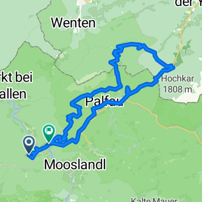
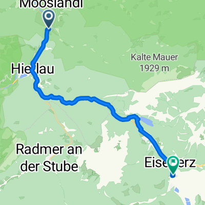
Großreifling Wildalpen
A cycling route starting in Landl, Styria, Austria.
Overview
About this route
- -:--
 - Duration
 - 26.3 km
 - Distance
 - 617 m
 - Ascent
 - 471 m
 - Descent
 - ---
 - Avg. speed
 - 605 m
 - Max. altitude
 
Route quality
Waytypes & surfaces along the route
Waytypes
Quiet road
0.3 km
(1 %)
Undefined
26 km
(99 %)
Surfaces
Paved
19.2 km
(73 %)
Asphalt
18.9 km
(72 %)
Paved (undefined)
0.3 km
(1 %)
Undefined
7.1 km
(27 %)
Continue with Bikemap
Use, edit, or download this cycling route
You would like to ride Großreifling Wildalpen or customize it for your own trip? Here is what you can do with this Bikemap route:
Free features
- Save this route as favorite or in collections
 - Copy & plan your own version of this route
 - Sync your route with Garmin or Wahoo
 
Premium features
Free trial for 3 days, or one-time payment. More about Bikemap Premium.
- Navigate this route on iOS & Android
 - Export a GPX / KML file of this route
 - Create your custom printout (try it for free)
 - Download this route for offline navigation
 
Discover more Premium features.
Get Bikemap PremiumFrom our community
Other popular routes starting in Landl
Enns-Donau 04- Distance
 - 79.4 km
 - Ascent
 - 721 m
 - Descent
 - 1,019 m
 - Location
 - Landl, Styria, Austria
 
Enns-Donau 03- Distance
 - 6 km
 - Ascent
 - 133 m
 - Descent
 - 245 m
 - Location
 - Landl, Styria, Austria
 
R7 Großreifling - Ternberg- Distance
 - 65.8 km
 - Ascent
 - 439 m
 - Descent
 - 653 m
 - Location
 - Landl, Styria, Austria
 
Landl(Wildalpen)-Schladming(Ensstalradweg)- Distance
 - 104.8 km
 - Ascent
 - 883 m
 - Descent
 - 672 m
 - Location
 - Landl, Styria, Austria
 
3.den - Ennsradweg 2014- Distance
 - 87.6 km
 - Ascent
 - 662 m
 - Descent
 - 846 m
 - Location
 - Landl, Styria, Austria
 
Großreifling Wildalpen- Distance
 - 26.3 km
 - Ascent
 - 617 m
 - Descent
 - 471 m
 - Location
 - Landl, Styria, Austria
 
Großreifling nach Kienabauer Weg- Distance
 - 55.1 km
 - Ascent
 - 3,074 m
 - Descent
 - 3,204 m
 - Location
 - Landl, Styria, Austria
 
Erb 16, Kirchenlandl to St. Michael, Sankt Michael in der Obersteiermark- Distance
 - 108.1 km
 - Ascent
 - 547 m
 - Descent
 - 507 m
 - Location
 - Landl, Styria, Austria
 
Open it in the app


