

Schwarza-Dolmar-Kühndorf-mgn
A cycling route starting in Schwarza, Thuringia, Germany.
Overview
About this route
Nach der Überquerund des Autobahnzubringes geht es durch den Wald. Hier empfiehlt sich mindestens ein MTB Hardtail. Genau wie schon auf der Abfahrt vom Dolmar bis nach Kühndorf.
- -:--
- Duration
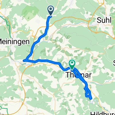
- 15.4 km
- Distance
- 434 m
- Ascent
- 470 m
- Descent
- ---
- Avg. speed
- ---
- Max. altitude
Continue with Bikemap
Use, edit, or download this cycling route
You would like to ride Schwarza-Dolmar-Kühndorf-mgn or customize it for your own trip? Here is what you can do with this Bikemap route:
Free features
- Save this route as favorite or in collections
- Copy & plan your own version of this route
- Sync your route with Garmin or Wahoo
Premium features
Free trial for 3 days, or one-time payment. More about Bikemap Premium.
- Navigate this route on iOS & Android
- Export a GPX / KML file of this route
- Create your custom printout (try it for free)
- Download this route for offline navigation
Discover more Premium features.
Get Bikemap PremiumFrom our community
Other popular routes starting in Schwarza
 Dolmarrundfahrt modifiziert
- Distance
- 69.6 km
- Ascent
- 851 m
- Descent
- 851 m
- Location
- Schwarza, Thuringia, Germany
 Schwarza-Dolmar-Kühndorf-mgn
- Distance
- 15.4 km
- Ascent
- 434 m
- Descent
- 470 m
- Location
- Schwarza, Thuringia, Germany
 Dolmarrundfahrt 2014
- Distance
- 22.7 km
- Ascent
- 260 m
- Descent
- 307 m
- Location
- Schwarza, Thuringia, Germany
 Bei Sankt Bartholomäi 9, Schwarza nach L1124 43a, Meiningen
- Distance
- 21.8 km
- Ascent
- 64 m
- Descent
- 135 m
- Location
- Schwarza, Thuringia, Germany
 Hauptstraße 81, Schwarza nach Zehntweg 117, Henfstädt
- Distance
- 41.5 km
- Ascent
- 266 m
- Descent
- 304 m
- Location
- Schwarza, Thuringia, Germany
 Sandgasse 99A, Benshausen nach Unterdorf 5, Kühndorf
- Distance
- 7.2 km
- Ascent
- 212 m
- Descent
- 195 m
- Location
- Schwarza, Thuringia, Germany
 21. Dolmar Rundfahrt
- Distance
- 66.8 km
- Ascent
- 505 m
- Descent
- 505 m
- Location
- Schwarza, Thuringia, Germany
 Dolmarrundfahrt 2014
- Distance
- 70 km
- Ascent
- 794 m
- Descent
- 794 m
- Location
- Schwarza, Thuringia, Germany
Open it in the app