

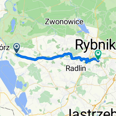
Pogrzebieńska 46, Racibórz do Pogrzebieńska 53, Racibórz
A cycling route starting in Pogrzebień, Silesian Voivodeship, Poland.
Overview
About this route
- 2 h 17 min
- Duration
- 36 km
- Distance
- 172 m
- Ascent
- 159 m
- Descent
- 15.8 km/h
- Avg. speed
- 240 m
- Max. altitude

Route quality
Waytypes & surfaces along the route
Waytypes
Road
10.8 km
(30 %)
Quiet road
9 km
(25 %)
Surfaces
Paved
27 km
(75 %)
Unpaved
3.6 km
(10 %)
Asphalt
27 km
(75 %)
Gravel
3.2 km
(9 %)
Continue with Bikemap
Use, edit, or download this cycling route
You would like to ride Pogrzebieńska 46, Racibórz do Pogrzebieńska 53, Racibórz or customize it for your own trip? Here is what you can do with this Bikemap route:
Free features
- Save this route as favorite or in collections
- Copy & plan your own version of this route
- Sync your route with Garmin or Wahoo
Premium features
Free trial for 3 days, or one-time payment. More about Bikemap Premium.
- Navigate this route on iOS & Android
- Export a GPX / KML file of this route
- Create your custom printout (try it for free)
- Download this route for offline navigation
Discover more Premium features.
Get Bikemap PremiumFrom our community
Other popular routes starting in Pogrzebień
 zbiornik racibòrz
- Distance
- 23.7 km
- Ascent
- 387 m
- Descent
- 392 m
- Location
- Pogrzebień, Silesian Voivodeship, Poland
 Kuliga 6, Kobyla do Kuliga 6, Kobyla
- Distance
- 47.2 km
- Ascent
- 1,313 m
- Descent
- 1,267 m
- Location
- Pogrzebień, Silesian Voivodeship, Poland
 Główna 111, Kobyla do Główna 111, Kobyla
- Distance
- 20.4 km
- Ascent
- 143 m
- Descent
- 146 m
- Location
- Pogrzebień, Silesian Voivodeship, Poland
 Pogrzebieńska 46, Racibórz do Pogrzebieńska 53, Racibórz
- Distance
- 36 km
- Ascent
- 172 m
- Descent
- 159 m
- Location
- Pogrzebień, Silesian Voivodeship, Poland
 Główna 111, Kobyla do Główna 111, Kobyla
- Distance
- 47.9 km
- Ascent
- 406 m
- Descent
- 451 m
- Location
- Pogrzebień, Silesian Voivodeship, Poland
 Rybnicka 121, Racibórz do Rybnicka 121, Racibórz
- Distance
- 17 km
- Ascent
- 39 m
- Descent
- 41 m
- Location
- Pogrzebień, Silesian Voivodeship, Poland
 Droga Wojewódzka 935, Racibórz do Zwycięstwa, Rybnik
- Distance
- 25.7 km
- Ascent
- 198 m
- Descent
- 203 m
- Location
- Pogrzebień, Silesian Voivodeship, Poland
 wyprawa po Polsce 2011 - dzień 8
- Distance
- 105.3 km
- Ascent
- 292 m
- Descent
- 257 m
- Location
- Pogrzebień, Silesian Voivodeship, Poland
Open it in the app