

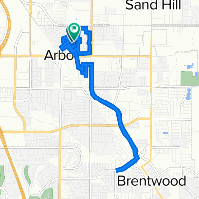
Marsh Creek Regional Trail, Oakley to 16 Minaret Rd, Oakley
A cycling route starting in Oakley, California, United States.
Overview
About this route
- 51 min
- Duration
- 12.7 km
- Distance
- 27 m
- Ascent
- 23 m
- Descent
- 15.1 km/h
- Avg. speed
- 12 m
- Max. altitude

Route quality
Waytypes & surfaces along the route
Waytypes
Cycleway
11.6 km
(91 %)
Road
0.5 km
(4 %)
Surfaces
Paved
11.4 km
(90 %)
Paved (undefined)
8.8 km
(69 %)
Asphalt
2.7 km
(21 %)
Undefined
1.3 km
(10 %)
Continue with Bikemap
Use, edit, or download this cycling route
You would like to ride Marsh Creek Regional Trail, Oakley to 16 Minaret Rd, Oakley or customize it for your own trip? Here is what you can do with this Bikemap route:
Free features
- Save this route as favorite or in collections
- Copy & plan your own version of this route
- Sync your route with Garmin or Wahoo
Premium features
Free trial for 3 days, or one-time payment. More about Bikemap Premium.
- Navigate this route on iOS & Android
- Export a GPX / KML file of this route
- Create your custom printout (try it for free)
- Download this route for offline navigation
Discover more Premium features.
Get Bikemap PremiumFrom our community
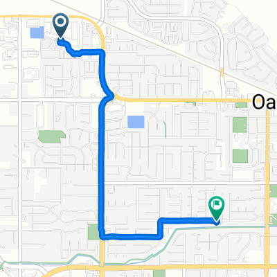
Other popular routes starting in Oakley
 2588 Margaret Ln, Brentwood to 2580 Margaret Ln, Brentwood
- Distance
- 14.5 km
- Ascent
- 20 m
- Descent
- 19 m
- Location
- Oakley, California, United States
 4/28 Morning
- Distance
- 21 km
- Ascent
- 24 m
- Descent
- 21 m
- Location
- Oakley, California, United States
 905 Chianti Way, Oakley to 225 Robinwood Ave, Oakley
- Distance
- 3.4 km
- Ascent
- 6 m
- Descent
- 9 m
- Location
- Oakley, California, United States
 Marsh Creek Regional Trail, Oakley to 16 Minaret Rd, Oakley
- Distance
- 12.7 km
- Ascent
- 27 m
- Descent
- 23 m
- Location
- Oakley, California, United States
 267–269 Merlot Ln, Oakley to 1191 Bacchini Ln, Brentwood
- Distance
- 17.3 km
- Ascent
- 35 m
- Descent
- 6 m
- Location
- Oakley, California, United States
 Mazant Loop 5397, Antioch to Mazant Loop 5397, Antioch
- Distance
- 25.6 km
- Ascent
- 117 m
- Descent
- 89 m
- Location
- Oakley, California, United States
 De Carol Lane 65, Oakley a Chianti Way 909, Oakley
- Distance
- 3.7 km
- Ascent
- 14 m
- Descent
- 6 m
- Location
- Oakley, California, United States
 Part 2 to Big Break
- Distance
- 5.9 km
- Ascent
- 0 m
- Descent
- 23 m
- Location
- Oakley, California, United States
Open it in the app