

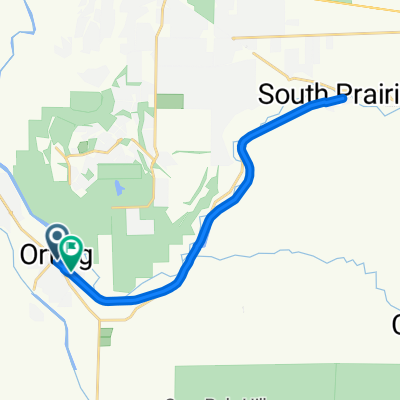
Foothills Trail, Orting to 760 Main St, Buckley
A cycling route starting in Orting, Washington, United States.
Overview
About this route
- 1 h 4 min
- Duration
- 16.7 km
- Distance
- 253 m
- Ascent
- 122 m
- Descent
- 15.5 km/h
- Avg. speed
- 227 m
- Max. altitude

Route quality
Waytypes & surfaces along the route
Waytypes
Cycleway
15 km
(90 %)
Quiet road
0.8 km
(5 %)
Undefined
0.8 km
(5 %)
Surfaces
Paved
15.2 km
(91 %)
Unpaved
0.5 km
(3 %)
Asphalt
14 km
(84 %)
Paved (undefined)
1.2 km
(7 %)
Continue with Bikemap
Use, edit, or download this cycling route
You would like to ride Foothills Trail, Orting to 760 Main St, Buckley or customize it for your own trip? Here is what you can do with this Bikemap route:
Free features
- Save this route as favorite or in collections
- Copy & plan your own version of this route
- Sync your route with Garmin or Wahoo
Premium features
Free trial for 3 days, or one-time payment. More about Bikemap Premium.
- Navigate this route on iOS & Android
- Export a GPX / KML file of this route
- Create your custom printout (try it for free)
- Download this route for offline navigation
Discover more Premium features.
Get Bikemap PremiumFrom our community
Other popular routes starting in Orting
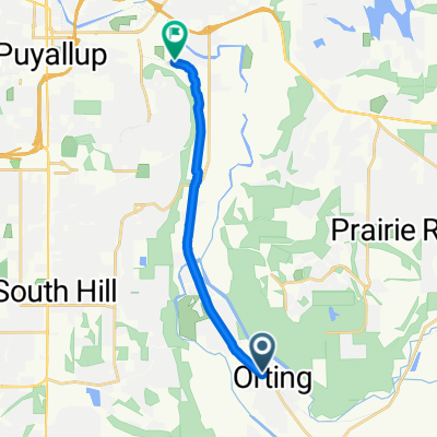
 Foothills Trail Out 'n Back
- Distance
- 23.3 km
- Ascent
- 60 m
- Descent
- 58 m
- Location
- Orting, Washington, United States
 Bonney Lake Scenic 50 Miler
- Distance
- 77.2 km
- Ascent
- 566 m
- Descent
- 568 m
- Location
- Orting, Washington, United States
 Van Scoyoc Avenue Southwest 125, Orting to Washington Avenue Southeast 425, Orting
- Distance
- 23.7 km
- Ascent
- 28 m
- Descent
- 36 m
- Location
- Orting, Washington, United States
 Foothills Trail, Puyallup to bridge, return, part B
- Distance
- 11.1 km
- Ascent
- 16 m
- Descent
- 32 m
- Location
- Orting, Washington, United States
 Foothills Trail, Orting to 760 Main St, Buckley
- Distance
- 16.7 km
- Ascent
- 253 m
- Descent
- 122 m
- Location
- Orting, Washington, United States
 Chief Emmons Lane Northwest, Orting to 108th Avenue East 3106, Edgewood
- Distance
- 21.8 km
- Ascent
- 91 m
- Descent
- 31 m
- Location
- Orting, Washington, United States
 ortnig
- Distance
- 7 km
- Ascent
- 270 m
- Descent
- 298 m
- Location
- Orting, Washington, United States
 Eumenclaw 50 Miler
- Distance
- 73.9 km
- Ascent
- 632 m
- Descent
- 630 m
- Location
- Orting, Washington, United States
Open it in the app