

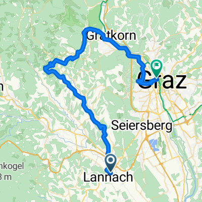
2. Lannacher Radmarathon am 17.6.2012 - Strecke B
A cycling route starting in Lannach, Styria, Austria.
Overview
About this route
Lannacher Cycling Marathon 2012: Route B
- -:--
- Duration
- 81.7 km
- Distance
- 647 m
- Ascent
- 644 m
- Descent
- ---
- Avg. speed
- ---
- Max. altitude
Route highlights
Points of interest along the route
Point of interest after 0 km
START: Billa (Fischerweg)
Point of interest after 81.7 km
ZIEL: Steinhalle Lannach
Continue with Bikemap
Use, edit, or download this cycling route
You would like to ride 2. Lannacher Radmarathon am 17.6.2012 - Strecke B or customize it for your own trip? Here is what you can do with this Bikemap route:
Free features
- Save this route as favorite or in collections
- Copy & plan your own version of this route
- Split it into stages to create a multi-day tour
- Sync your route with Garmin or Wahoo
Premium features
Free trial for 3 days, or one-time payment. More about Bikemap Premium.
- Navigate this route on iOS & Android
- Export a GPX / KML file of this route
- Create your custom printout (try it for free)
- Download this route for offline navigation
Discover more Premium features.
Get Bikemap PremiumFrom our community
Other popular routes starting in Lannach

 Lannach-Tour - von den Straußeneiern zum Kernöl
- Distance
- 49.5 km
- Ascent
- 660 m
- Descent
- 658 m
- Location
- Lannach, Styria, Austria
 Radteam Lannach Gemeinderadtag am 29. Mai 2011 (Strecke C "CLASSIC", 73 km); ORANGE
- Distance
- 72.9 km
- Ascent
- 547 m
- Descent
- 547 m
- Location
- Lannach, Styria, Austria
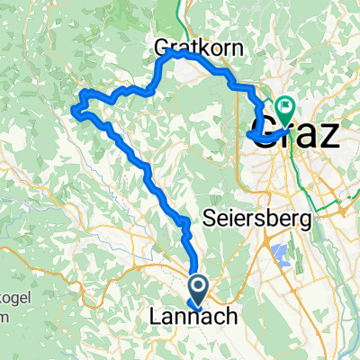
 03 - Lieboch - Graz (über Rein)
- Distance
- 56.3 km
- Ascent
- 864 m
- Descent
- 834 m
- Location
- Lannach, Styria, Austria
 03 - Lieboch - Graz
- Distance
- 54.9 km
- Ascent
- 630 m
- Descent
- 600 m
- Location
- Lannach, Styria, Austria
 2. Lannacher Radtag am 17. Juni 2012 - Strecke B
- Distance
- 81.7 km
- Ascent
- 655 m
- Descent
- 652 m
- Location
- Lannach, Styria, Austria
 Hauptstraße 68, Heuholz nach Hauptstraße 68, Heuholz
- Distance
- 40.3 km
- Ascent
- 715 m
- Descent
- 714 m
- Location
- Lannach, Styria, Austria
 Weststeiermark
- Distance
- 21.1 km
- Ascent
- 661 m
- Descent
- 403 m
- Location
- Lannach, Styria, Austria
Open it in the app