

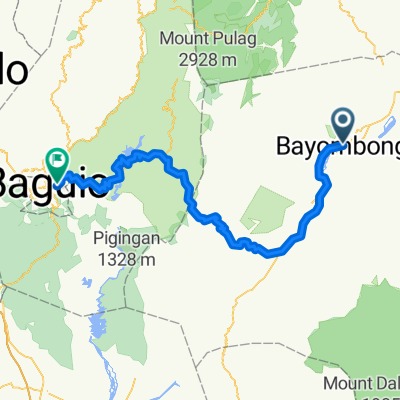
Umaguing Street, Bayombong to Umaguing Street, Bayombong
A cycling route starting in Bayombong, Cagayan Valley, Philippines.
Overview
About this route
- 4 h 24 min
- Duration
- 14.9 km
- Distance
- 81 m
- Ascent
- 79 m
- Descent
- 3.4 km/h
- Avg. speed
- 296 m
- Max. altitude

Route quality
Waytypes & surfaces along the route
Waytypes
Road
11.3 km
(76 %)
Quiet road
2.8 km
(19 %)
Access road
0.7 km
(5 %)
Surfaces
Paved
8.8 km
(59 %)
Concrete
8.8 km
(59 %)
Undefined
6.1 km
(41 %)
Continue with Bikemap
Use, edit, or download this cycling route
You would like to ride Umaguing Street, Bayombong to Umaguing Street, Bayombong or customize it for your own trip? Here is what you can do with this Bikemap route:
Free features
- Save this route as favorite or in collections
- Copy & plan your own version of this route
- Sync your route with Garmin or Wahoo
Premium features
Free trial for 3 days, or one-time payment. More about Bikemap Premium.
- Navigate this route on iOS & Android
- Export a GPX / KML file of this route
- Create your custom printout (try it for free)
- Download this route for offline navigation
Discover more Premium features.
Get Bikemap PremiumFrom our community
Other popular routes starting in Bayombong
 BACK TO BACK
- Distance
- 48 km
- Ascent
- 2,138 m
- Descent
- 1,874 m
- Location
- Bayombong, Cagayan Valley, Philippines
 F4GR+VG2, Bayombong to Dumlao Boulevard 10-34, Bayombong
- Distance
- 28 km
- Ascent
- 376 m
- Descent
- 382 m
- Location
- Bayombong, Cagayan Valley, Philippines
 F4PW+WCR, Bayombong to Zulueta Street 1370, Bayombong
- Distance
- 12.9 km
- Ascent
- 116 m
- Descent
- 140 m
- Location
- Bayombong, Cagayan Valley, Philippines
 Masoc, Bayombog
- Distance
- 15.9 km
- Ascent
- 246 m
- Descent
- 248 m
- Location
- Bayombong, Cagayan Valley, Philippines
 Tour de philipine4
- Distance
- 134.1 km
- Ascent
- 3,205 m
- Descent
- 1,995 m
- Location
- Bayombong, Cagayan Valley, Philippines
 Jose Abad Santos Street 37, Bayombong to Zulueta Street 1370, Bayombong
- Distance
- 14.5 km
- Ascent
- 118 m
- Descent
- 146 m
- Location
- Bayombong, Cagayan Valley, Philippines
 Route to Maharlika Highway, Bayombong
- Distance
- 20.7 km
- Ascent
- 48 m
- Descent
- 48 m
- Location
- Bayombong, Cagayan Valley, Philippines
 Cabarroguis Street, Bayombong to Dumlao Boulevard 16, Bayombong
- Distance
- 24 km
- Ascent
- 727 m
- Descent
- 809 m
- Location
- Bayombong, Cagayan Valley, Philippines
Open it in the app