

Du hast den Arsch offen
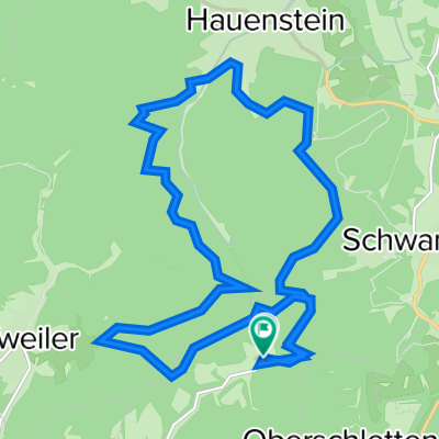
A cycling route starting in Oberschlettenbach, Rhineland-Palatinate, Germany.
Overview
About this route
- -:--
- Duration
- 60.7 km
- Distance
- 441 m
- Ascent
- 435 m
- Descent
- ---
- Avg. speed
- ---
- Max. altitude
Continue with Bikemap
Use, edit, or download this cycling route
You would like to ride Du hast den Arsch offen or customize it for your own trip? Here is what you can do with this Bikemap route:
Free features
- Save this route as favorite or in collections
- Copy & plan your own version of this route
- Sync your route with Garmin or Wahoo
Premium features
Free trial for 3 days, or one-time payment. More about Bikemap Premium.
- Navigate this route on iOS & Android
- Export a GPX / KML file of this route
- Create your custom printout (try it for free)
- Download this route for offline navigation
Discover more Premium features.
Get Bikemap PremiumFrom our community
Other popular routes starting in Oberschlettenbach
 Ritter 37 520
- Distance
- 37 km
- Ascent
- 535 m
- Descent
- 535 m
- Location
- Oberschlettenbach, Rhineland-Palatinate, Germany
 20130721_092147.gpx
- Distance
- 52.2 km
- Ascent
- 712 m
- Descent
- 712 m
- Location
- Oberschlettenbach, Rhineland-Palatinate, Germany
 Felsentour 41 450
- Distance
- 41.3 km
- Ascent
- 419 m
- Descent
- 420 m
- Location
- Oberschlettenbach, Rhineland-Palatinate, Germany
 Bärenthal Weissenburg
- Distance
- 50.2 km
- Ascent
- 469 m
- Descent
- 476 m
- Location
- Oberschlettenbach, Rhineland-Palatinate, Germany
 Kleine Pfalzrunde
- Distance
- 71.3 km
- Ascent
- 513 m
- Descent
- 511 m
- Location
- Oberschlettenbach, Rhineland-Palatinate, Germany
 Pfalzrunde
- Distance
- 79 km
- Ascent
- 661 m
- Descent
- 660 m
- Location
- Oberschlettenbach, Rhineland-Palatinate, Germany
 Barenbrunnerhof 031014
- Distance
- 18.7 km
- Ascent
- 655 m
- Descent
- 655 m
- Location
- Oberschlettenbach, Rhineland-Palatinate, Germany
 Du hast den Arsch offen
- Distance
- 60.7 km
- Ascent
- 441 m
- Descent
- 435 m
- Location
- Oberschlettenbach, Rhineland-Palatinate, Germany
Open it in the app