

林口長庚到關渡橋(經大科路、成泰路)
A cycling route starting in Taoyuan District, Taiwan, Taiwan.
Overview
About this route
大科路十分危險
車友們請減速慢行
- -:--
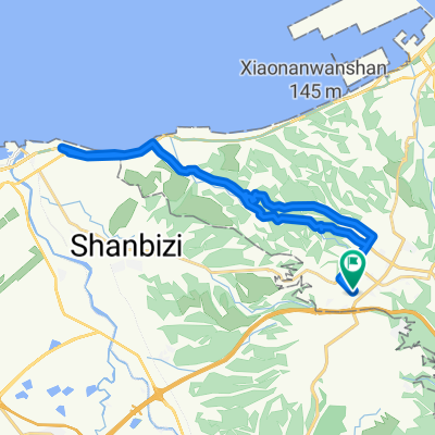
- Duration
- 15.9 km
- Distance
- 103 m
- Ascent
- 340 m
- Descent
- ---
- Avg. speed
- ---
- Max. altitude

Route highlights
Points of interest along the route
Point of interest after 1.7 km
麗園國小
Point of interest after 7.3 km
黎明技術學院
Point of interest after 9.9 km
Drinking water after 10.9 km
9點開門
Drinking water after 11 km
Continue with Bikemap
Use, edit, or download this cycling route
You would like to ride 林口長庚到關渡橋(經大科路、成泰路) or customize it for your own trip? Here is what you can do with this Bikemap route:
Free features
- Save this route as favorite or in collections
- Copy & plan your own version of this route
- Sync your route with Garmin or Wahoo
Premium features
Free trial for 3 days, or one-time payment. More about Bikemap Premium.
- Navigate this route on iOS & Android
- Export a GPX / KML file of this route
- Create your custom printout (try it for free)
- Download this route for offline navigation
Discover more Premium features.
Get Bikemap PremiumFrom our community
Other popular routes starting in Taoyuan District
 樹琳大棟山
樹琳大棟山- Distance
- 4.4 km
- Ascent
- 369 m
- Descent
- 80 m
- Location
- Taoyuan District, Taiwan, Taiwan
 一日桃高圖
一日桃高圖- Distance
- 362.3 km
- Ascent
- 155 m
- Descent
- 246 m
- Location
- Taoyuan District, Taiwan, Taiwan
 鶯歌大榕樹
鶯歌大榕樹- Distance
- 22.2 km
- Ascent
- 637 m
- Descent
- 642 m
- Location
- Taoyuan District, Taiwan, Taiwan
 鶯歌到大溪
鶯歌到大溪- Distance
- 13.7 km
- Ascent
- 160 m
- Descent
- 84 m
- Location
- Taoyuan District, Taiwan, Taiwan
 大棟山
大棟山- Distance
- 33.7 km
- Ascent
- 1,130 m
- Descent
- 1,132 m
- Location
- Taoyuan District, Taiwan, Taiwan
 熊空茶園
熊空茶園- Distance
- 15.5 km
- Ascent
- 805 m
- Descent
- 146 m
- Location
- Taoyuan District, Taiwan, Taiwan
 Linkou-林口 to Dayuan-大圓
- Distance
- 32.2 km
- Ascent
- 310 m
- Descent
- 310 m
- Location
- Taoyuan District, Taiwan, Taiwan
 100.03.12 鶯歌到三坑 <慢騎cloub>
- Distance
- 43.1 km
- Ascent
- 224 m
- Descent
- 224 m
- Location
- Taoyuan District, Taiwan, Taiwan
Open it in the app