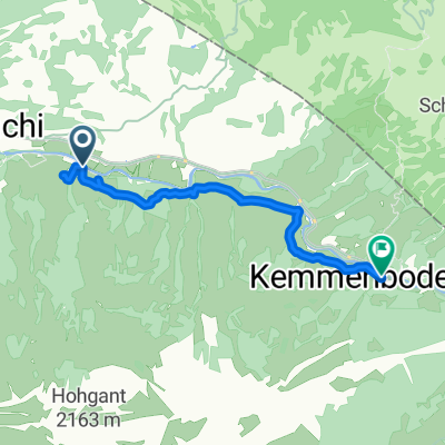
Marbach-Runde
A cycling route starting in Wald, Canton of Bern, Switzerland.
Overview
About this route
Marbach-Schangnau-Schallenbergpass-Oberei-Röthenbach-Eggiwil-Blapbach-Trubschachen-Wiggen-Marbach.
Ich versuch das mal mit dem Rennrad und teile meine Erfahrung mit.
- -:--
- Duration
- 51 km
- Distance
- 1,207 m
- Ascent
- 1,209 m
- Descent
- ---
- Avg. speed
- 1,167 m
- Avg. speed
Route quality
Waytypes & surfaces along the route
Waytypes
Busy road
32.5 km
(64 %)
Quiet road
12.2 km
(24 %)
Surfaces
Paved
23.2 km
(46 %)
Unpaved
0.3 km
(<1 %)
Asphalt
18.4 km
(36 %)
Paved (undefined)
4.9 km
(10 %)
Continue with Bikemap
Use, edit, or download this cycling route
You would like to ride Marbach-Runde or customize it for your own trip? Here is what you can do with this Bikemap route:
Free features
- Save this route as favorite or in collections
- Copy & plan your own version of this route
- Sync your route with Garmin or Wahoo
Premium features
Free trial for 3 days, or one-time payment. More about Bikemap Premium.
- Navigate this route on iOS & Android
- Export a GPX / KML file of this route
- Create your custom printout (try it for free)
- Download this route for offline navigation
Discover more Premium features.
Get Bikemap PremiumFrom our community
Other popular routes starting in Wald
- Marbach Panoramatour
- Distance
- 23.3 km
- Ascent
- 951 m
- Descent
- 951 m
- Location
- Wald, Canton of Bern, Switzerland
- kemmeriboden habkern
- Distance
- 18.2 km
- Ascent
- 670 m
- Descent
- 575 m
- Location
- Wald, Canton of Bern, Switzerland
- BRM 600 - 5
- Distance
- 102.4 km
- Ascent
- 387 m
- Descent
- 791 m
- Location
- Wald, Canton of Bern, Switzerland
- MarbachEgg - Sörenberg - Hilferenpass
- Distance
- 47.2 km
- Ascent
- 1,420 m
- Descent
- 1,421 m
- Location
- Wald, Canton of Bern, Switzerland
- Dorfstrasse 48, Marbach nach Dorfstrasse 48, Marbach
- Distance
- 28.1 km
- Ascent
- 772 m
- Descent
- 773 m
- Location
- Wald, Canton of Bern, Switzerland
- Marbacher Panoramarunde
- Distance
- 21.9 km
- Ascent
- 956 m
- Descent
- 956 m
- Location
- Wald, Canton of Bern, Switzerland
- Um die Sieben Hengste
- Distance
- 48.8 km
- Ascent
- 1,343 m
- Descent
- 1,335 m
- Location
- Wald, Canton of Bern, Switzerland
- Marbacher Panoramarunde
- Distance
- 26.4 km
- Ascent
- 954 m
- Descent
- 954 m
- Location
- Wald, Canton of Bern, Switzerland
Open it in the app